You are here: Home > Network List > US - United States National Seismic Network Stations List
> Station EGMT Eagleton, Montana, USA > Earthquake Result Viewer
EGMT Eagleton, Montana, USA - Earthquake Result Viewer
*The percent match for this event was below the threshold and hence no stack was calculated.
| Earthquake location: |
Afghanistan-Tajikistan Bord Reg. |
| Earthquake latitude/longitude: |
39.0/70.6 |
| Earthquake time(UTC): |
2021/07/10 (191) 02:14:43 GMT |
| Earthquake Depth: |
17 km |
| Earthquake Magnitude: |
5.8 Mww |
| Earthquake Catalog/Contributor: |
NEIC PDE/us |
|
| Network: |
US United States National Seismic Network |
| Station: |
EGMT Eagleton, Montana, USA |
| Lat/Lon: |
48.02 N/109.75 W |
| Elevation: |
1055 m |
|
| Distance: |
93.4 deg |
| Az: |
0.22 deg |
| Baz: |
359.745 deg |
| Ray Param: |
$rayparam |
*The percent match for this event was below the threshold and hence was not used in the summary stack. |
|
| Radial Match: |
59.352886 % |
| Radial Bump: |
400 |
| Transverse Match: |
61.958416 % |
| Transverse Bump: |
400 |
| SOD ConfigId: |
25131211 |
| Insert Time: |
2021-07-24 02:33:20.612 +0000 |
| GWidth: |
2.5 |
| Max Bumps: |
400 |
| Tol: |
0.001 |
|
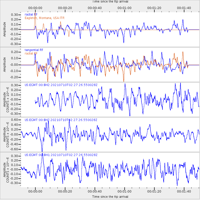
Signal To Noise
| Channel | StoN | STA | LTA |
| US:EGMT:00:BHZ:20210710T02:27:26.550028Z | 3.873274 | 2.6901864E-7 | 6.94551E-8 |
| US:EGMT:00:BH1:20210710T02:27:26.550028Z | 1.5051714 | 1.4924045E-7 | 9.91518E-8 |
| US:EGMT:00:BH2:20210710T02:27:26.550028Z | 0.6871468 | 6.697866E-8 | 9.747358E-8 |
| Arrivals |
| Ps | |
| PpPs | |
| PsPs/PpSs | |


