You are here: Home > Network List > CI - Caltech Regional Seismic Network Stations List
> Station MPP McPhearson Peak > Earthquake Result Viewer
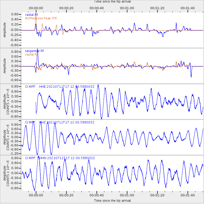
MPP McPhearson Peak - Earthquake Result Viewer
*The percent match for this event was below the threshold and hence no stack was calculated.
| Earthquake location: |
Andreanof Islands, Aleutian Is. |
| Earthquake latitude/longitude: |
51.8/-176.0 |
| Earthquake time(UTC): |
2021/07/11 (192) 17:04:37 GMT |
| Earthquake Depth: |
60 km |
| Earthquake Magnitude: |
4.9 Mww |
| Earthquake Catalog/Contributor: |
NEIC PDE/us |
|
| Network: |
CI Caltech Regional Seismic Network |
| Station: |
MPP McPhearson Peak |
| Lat/Lon: |
34.89 N/119.81 W |
| Elevation: |
1739 m |
|
| Distance: |
43.1 deg |
| Az: |
90.425 deg |
| Baz: |
310.899 deg |
| Ray Param: |
$rayparam |
*The percent match for this event was below the threshold and hence was not used in the summary stack. |
|
| Radial Match: |
61.01994 % |
| Radial Bump: |
400 |
| Transverse Match: |
70.762245 % |
| Transverse Bump: |
400 |
| SOD ConfigId: |
25131211 |
| Insert Time: |
2021-07-25 17:07:55.356 +0000 |
| GWidth: |
2.5 |
| Max Bumps: |
400 |
| Tol: |
0.001 |
|
Signal To Noise
| Channel | StoN | STA | LTA |
| CI:MPP: :HHZ:20210711T17:12:00.588003Z | 2.8885818 | 8.0245513E-7 | 2.7780246E-7 |
| CI:MPP: :HHN:20210711T17:12:00.588003Z | 2.9587011 | 7.104389E-7 | 2.4011848E-7 |
| CI:MPP: :HHE:20210711T17:12:00.588003Z | 1.4375018 | 5.6423386E-7 | 3.9251003E-7 |
| Arrivals |
| Ps | |
| PpPs | |
| PsPs/PpSs | |


