You are here: Home > Network List > US - United States National Seismic Network Stations List
> Station EGMT Eagleton, Montana, USA > Earthquake Result Viewer
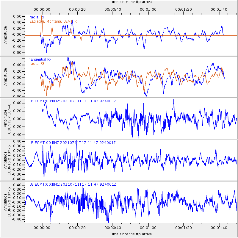
EGMT Eagleton, Montana, USA - Earthquake Result Viewer
*The percent match for this event was below the threshold and hence no stack was calculated.
| Earthquake location: |
Andreanof Islands, Aleutian Is. |
| Earthquake latitude/longitude: |
51.8/-176.0 |
| Earthquake time(UTC): |
2021/07/11 (192) 17:04:37 GMT |
| Earthquake Depth: |
60 km |
| Earthquake Magnitude: |
4.9 Mww |
| Earthquake Catalog/Contributor: |
NEIC PDE/us |
|
| Network: |
US United States National Seismic Network |
| Station: |
EGMT Eagleton, Montana, USA |
| Lat/Lon: |
48.02 N/109.75 W |
| Elevation: |
1055 m |
|
| Distance: |
41.5 deg |
| Az: |
67.989 deg |
| Baz: |
300.887 deg |
| Ray Param: |
$rayparam |
*The percent match for this event was below the threshold and hence was not used in the summary stack. |
|
| Radial Match: |
62.45142 % |
| Radial Bump: |
400 |
| Transverse Match: |
42.362576 % |
| Transverse Bump: |
400 |
| SOD ConfigId: |
25131211 |
| Insert Time: |
2021-07-25 17:22:33.198 +0000 |
| GWidth: |
2.5 |
| Max Bumps: |
400 |
| Tol: |
0.001 |
|
Signal To Noise
| Channel | StoN | STA | LTA |
| US:EGMT:00:BHZ:20210711T17:11:47.924001Z | 1.9404801 | 1.6383753E-7 | 8.4431434E-8 |
| US:EGMT:00:BH1:20210711T17:11:47.924001Z | 1.3025254 | 1.5183772E-7 | 1.165718E-7 |
| US:EGMT:00:BH2:20210711T17:11:47.924001Z | 0.84907335 | 1.2572377E-7 | 1.4807175E-7 |
| Arrivals |
| Ps | |
| PpPs | |
| PsPs/PpSs | |


