You are here: Home > Network List > US - United States National Seismic Network Stations List
> Station MSO Missoula, Montana, USA > Earthquake Result Viewer
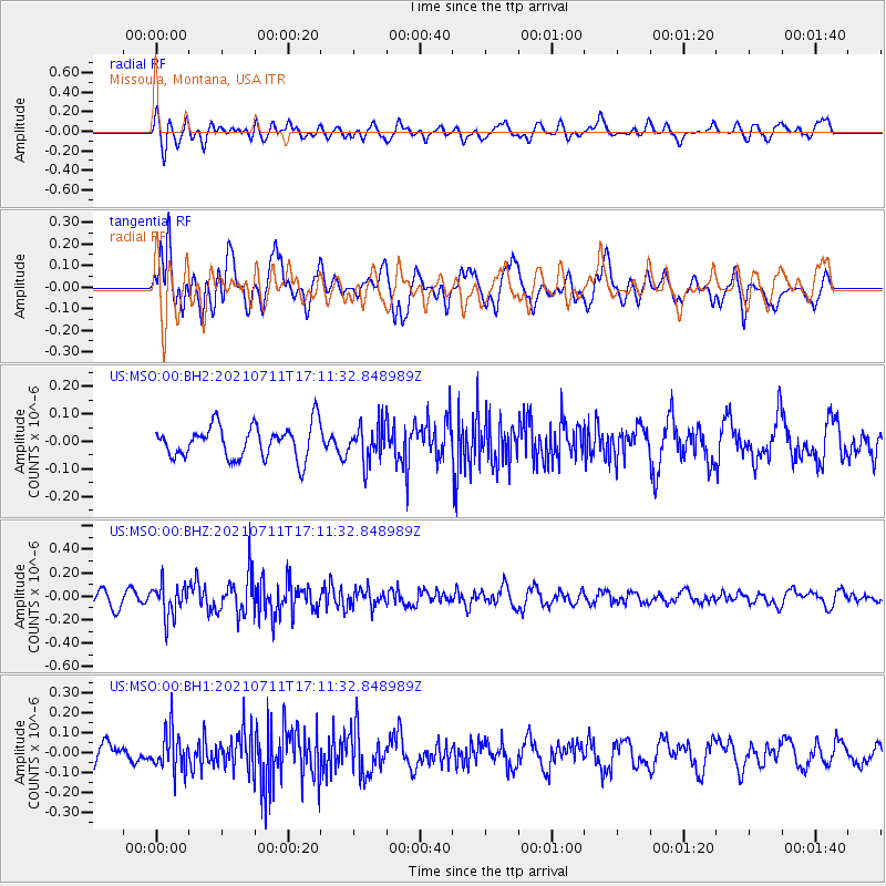
MSO Missoula, Montana, USA - Earthquake Result Viewer
*The percent match for this event was below the threshold and hence no stack was calculated.
| Earthquake location: |
Andreanof Islands, Aleutian Is. |
| Earthquake latitude/longitude: |
51.8/-176.0 |
| Earthquake time(UTC): |
2021/07/11 (192) 17:04:37 GMT |
| Earthquake Depth: |
60 km |
| Earthquake Magnitude: |
4.9 Mww |
| Earthquake Catalog/Contributor: |
NEIC PDE/us |
|
| Network: |
US United States National Seismic Network |
| Station: |
MSO Missoula, Montana, USA |
| Lat/Lon: |
46.83 N/113.94 W |
| Elevation: |
1264 m |
|
| Distance: |
39.7 deg |
| Az: |
71.804 deg |
| Baz: |
300.712 deg |
| Ray Param: |
$rayparam |
*The percent match for this event was below the threshold and hence was not used in the summary stack. |
|
| Radial Match: |
48.28326 % |
| Radial Bump: |
400 |
| Transverse Match: |
62.900623 % |
| Transverse Bump: |
400 |
| SOD ConfigId: |
25131211 |
| Insert Time: |
2021-07-25 17:22:45.527 +0000 |
| GWidth: |
2.5 |
| Max Bumps: |
400 |
| Tol: |
0.001 |
|
Signal To Noise
| Channel | StoN | STA | LTA |
| US:MSO:00:BHZ:20210711T17:11:32.848989Z | 1.9326284 | 1.3714451E-7 | 7.096269E-8 |
| US:MSO:00:BH1:20210711T17:11:32.848989Z | 1.9172468 | 1.01456436E-7 | 5.2917777E-8 |
| US:MSO:00:BH2:20210711T17:11:32.848989Z | 1.1006179 | 6.616578E-8 | 6.0116946E-8 |
| Arrivals |
| Ps | |
| PpPs | |
| PsPs/PpSs | |


