You are here: Home > Network List > UU - University of Utah Regional Network Stations List
> Station CCUT Cedar City, UT, USA > Earthquake Result Viewer
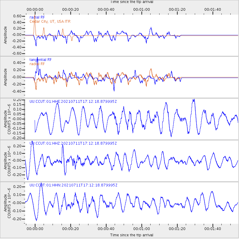
CCUT Cedar City, UT, USA - Earthquake Result Viewer
*The percent match for this event was below the threshold and hence no stack was calculated.
| Earthquake location: |
Andreanof Islands, Aleutian Is. |
| Earthquake latitude/longitude: |
51.8/-176.0 |
| Earthquake time(UTC): |
2021/07/11 (192) 17:04:37 GMT |
| Earthquake Depth: |
60 km |
| Earthquake Magnitude: |
4.9 Mww |
| Earthquake Catalog/Contributor: |
NEIC PDE/us |
|
| Network: |
UU University of Utah Regional Network |
| Station: |
CCUT Cedar City, UT, USA |
| Lat/Lon: |
37.55 N/113.36 W |
| Elevation: |
2127 m |
|
| Distance: |
45.3 deg |
| Az: |
82.696 deg |
| Baz: |
309.151 deg |
| Ray Param: |
$rayparam |
*The percent match for this event was below the threshold and hence was not used in the summary stack. |
|
| Radial Match: |
61.14759 % |
| Radial Bump: |
400 |
| Transverse Match: |
77.00998 % |
| Transverse Bump: |
400 |
| SOD ConfigId: |
25131211 |
| Insert Time: |
2021-07-25 17:23:00.598 +0000 |
| GWidth: |
2.5 |
| Max Bumps: |
400 |
| Tol: |
0.001 |
|
Signal To Noise
| Channel | StoN | STA | LTA |
| UU:CCUT:01:HHZ:20210711T17:12:18.879995Z | 1.1365427 | 1.101089E-7 | 9.688057E-8 |
| UU:CCUT:01:HHN:20210711T17:12:18.879995Z | 2.2931423 | 1.5915268E-7 | 6.9403754E-8 |
| UU:CCUT:01:HHE:20210711T17:12:18.879995Z | 0.58926964 | 5.287333E-8 | 8.972688E-8 |
| Arrivals |
| Ps | |
| PpPs | |
| PsPs/PpSs | |


