You are here: Home > Network List > CI - Caltech Regional Seismic Network Stations List
> Station BFS Mt Baldy Forest Station > Earthquake Result Viewer
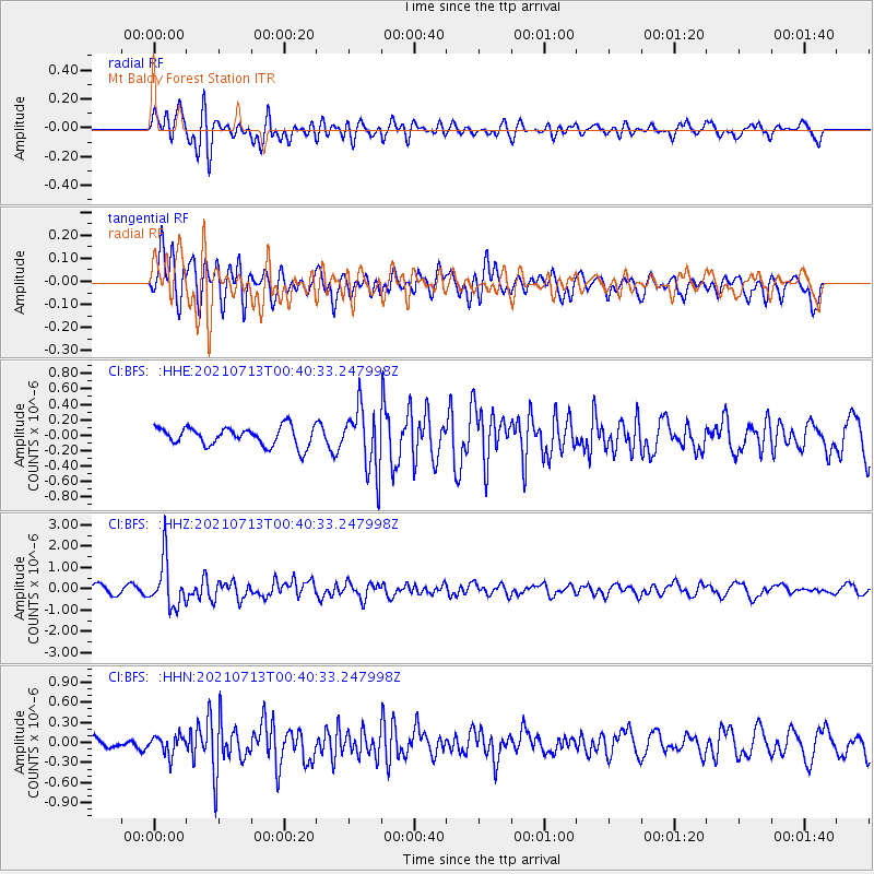
BFS Mt Baldy Forest Station - Earthquake Result Viewer
*The percent match for this event was below the threshold and hence no stack was calculated.
| Earthquake location: |
Kuril Islands |
| Earthquake latitude/longitude: |
46.2/151.7 |
| Earthquake time(UTC): |
2021/07/13 (194) 00:30:16 GMT |
| Earthquake Depth: |
33 km |
| Earthquake Magnitude: |
5.6 Mww |
| Earthquake Catalog/Contributor: |
NEIC PDE/us |
|
| Network: |
CI Caltech Regional Seismic Network |
| Station: |
BFS Mt Baldy Forest Station |
| Lat/Lon: |
34.24 N/117.66 W |
| Elevation: |
1312 m |
|
| Distance: |
66.7 deg |
| Az: |
64.433 deg |
| Baz: |
310.835 deg |
| Ray Param: |
$rayparam |
*The percent match for this event was below the threshold and hence was not used in the summary stack. |
|
| Radial Match: |
77.43879 % |
| Radial Bump: |
400 |
| Transverse Match: |
63.216988 % |
| Transverse Bump: |
400 |
| SOD ConfigId: |
25131211 |
| Insert Time: |
2021-07-27 00:39:32.693 +0000 |
| GWidth: |
2.5 |
| Max Bumps: |
400 |
| Tol: |
0.001 |
|
Signal To Noise
| Channel | StoN | STA | LTA |
| CI:BFS: :HHZ:20210713T00:40:33.247998Z | 5.692087 | 1.0998374E-6 | 1.9322215E-7 |
| CI:BFS: :HHN:20210713T00:40:33.247998Z | 1.7584515 | 1.4049928E-7 | 7.9899436E-8 |
| CI:BFS: :HHE:20210713T00:40:33.247998Z | 3.409647 | 4.1044947E-7 | 1.2037889E-7 |
| Arrivals |
| Ps | |
| PpPs | |
| PsPs/PpSs | |


