You are here: Home > Network List > CI - Caltech Regional Seismic Network Stations List
> Station MPM Manuel Prospect Mine, California, USA > Earthquake Result Viewer
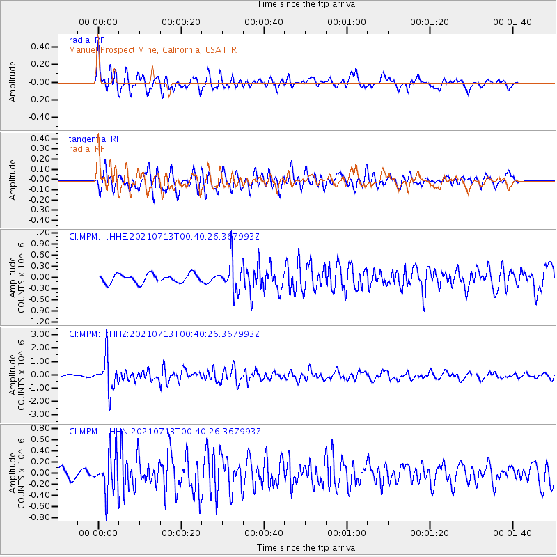
MPM Manuel Prospect Mine, California, USA - Earthquake Result Viewer
*The percent match for this event was below the threshold and hence no stack was calculated.
| Earthquake location: |
Kuril Islands |
| Earthquake latitude/longitude: |
46.2/151.7 |
| Earthquake time(UTC): |
2021/07/13 (194) 00:30:16 GMT |
| Earthquake Depth: |
33 km |
| Earthquake Magnitude: |
5.6 Mww |
| Earthquake Catalog/Contributor: |
NEIC PDE/us |
|
| Network: |
CI Caltech Regional Seismic Network |
| Station: |
MPM Manuel Prospect Mine, California, USA |
| Lat/Lon: |
36.06 N/117.49 W |
| Elevation: |
185 m |
|
| Distance: |
65.6 deg |
| Az: |
62.826 deg |
| Baz: |
310.282 deg |
| Ray Param: |
$rayparam |
*The percent match for this event was below the threshold and hence was not used in the summary stack. |
|
| Radial Match: |
78.7077 % |
| Radial Bump: |
400 |
| Transverse Match: |
78.7335 % |
| Transverse Bump: |
400 |
| SOD ConfigId: |
25131211 |
| Insert Time: |
2021-07-27 00:40:18.092 +0000 |
| GWidth: |
2.5 |
| Max Bumps: |
400 |
| Tol: |
0.001 |
|
Signal To Noise
| Channel | StoN | STA | LTA |
| CI:MPM: :HHZ:20210713T00:40:26.367993Z | 12.494771 | 1.257267E-6 | 1.0062345E-7 |
| CI:MPM: :HHN:20210713T00:40:26.367993Z | 3.6973557 | 3.7252977E-7 | 1.00755734E-7 |
| CI:MPM: :HHE:20210713T00:40:26.367993Z | 3.7520673 | 4.282148E-7 | 1.14127694E-7 |
| Arrivals |
| Ps | |
| PpPs | |
| PsPs/PpSs | |


