You are here: Home > Network List > CI - Caltech Regional Seismic Network Stations List
> Station SMM Simmler, CA, USA > Earthquake Result Viewer
SMM Simmler, CA, USA - Earthquake Result Viewer
*The percent match for this event was below the threshold and hence no stack was calculated.
| Earthquake location: |
Kuril Islands |
| Earthquake latitude/longitude: |
46.2/151.7 |
| Earthquake time(UTC): |
2021/07/13 (194) 00:30:16 GMT |
| Earthquake Depth: |
33 km |
| Earthquake Magnitude: |
5.6 Mww |
| Earthquake Catalog/Contributor: |
NEIC PDE/us |
|
| Network: |
CI Caltech Regional Seismic Network |
| Station: |
SMM Simmler, CA, USA |
| Lat/Lon: |
35.31 N/120.00 W |
| Elevation: |
599 m |
|
| Distance: |
64.5 deg |
| Az: |
64.899 deg |
| Baz: |
309.701 deg |
| Ray Param: |
$rayparam |
*The percent match for this event was below the threshold and hence was not used in the summary stack. |
|
| Radial Match: |
62.655342 % |
| Radial Bump: |
400 |
| Transverse Match: |
64.963135 % |
| Transverse Bump: |
400 |
| SOD ConfigId: |
25131211 |
| Insert Time: |
2021-07-27 00:40:49.268 +0000 |
| GWidth: |
2.5 |
| Max Bumps: |
400 |
| Tol: |
0.001 |
|
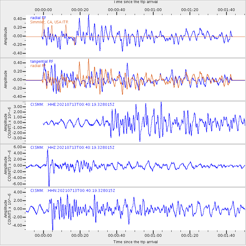
Signal To Noise
| Channel | StoN | STA | LTA |
| CI:SMM: :HHZ:20210713T00:40:19.328015Z | 6.756604 | 2.441347E-6 | 3.6132755E-7 |
| CI:SMM: :HHN:20210713T00:40:19.328015Z | 1.8916318 | 1.1839057E-6 | 6.258648E-7 |
| CI:SMM: :HHE:20210713T00:40:19.328015Z | 1.166804 | 4.78235E-7 | 4.0986748E-7 |
| Arrivals |
| Ps | |
| PpPs | |
| PsPs/PpSs | |


