You are here: Home > Network List > CI - Caltech Regional Seismic Network Stations List
> Station SWS Sam W. Stewart, Westmorland, CA, USA > Earthquake Result Viewer
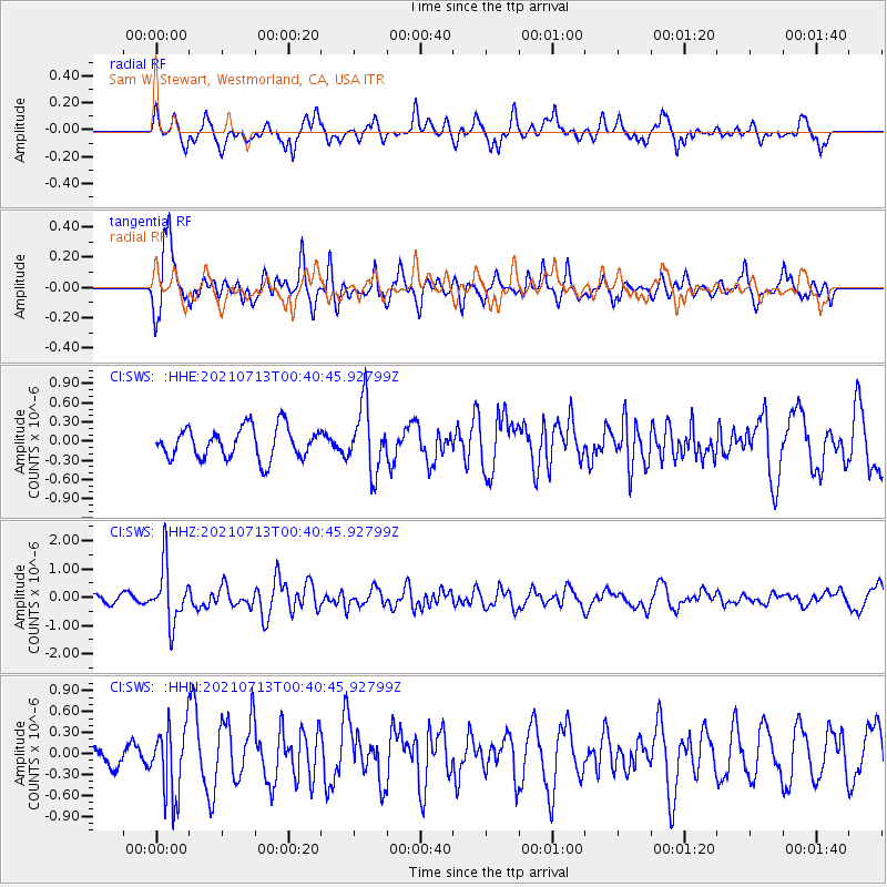
SWS Sam W. Stewart, Westmorland, CA, USA - Earthquake Result Viewer
*The percent match for this event was below the threshold and hence no stack was calculated.
| Earthquake location: |
Kuril Islands |
| Earthquake latitude/longitude: |
46.2/151.7 |
| Earthquake time(UTC): |
2021/07/13 (194) 00:30:16 GMT |
| Earthquake Depth: |
33 km |
| Earthquake Magnitude: |
5.6 Mww |
| Earthquake Catalog/Contributor: |
NEIC PDE/us |
|
| Network: |
CI Caltech Regional Seismic Network |
| Station: |
SWS Sam W. Stewart, Westmorland, CA, USA |
| Lat/Lon: |
32.94 N/115.80 W |
| Elevation: |
140 m |
|
| Distance: |
68.7 deg |
| Az: |
64.373 deg |
| Baz: |
311.838 deg |
| Ray Param: |
$rayparam |
*The percent match for this event was below the threshold and hence was not used in the summary stack. |
|
| Radial Match: |
62.72693 % |
| Radial Bump: |
384 |
| Transverse Match: |
74.6982 % |
| Transverse Bump: |
400 |
| SOD ConfigId: |
25131211 |
| Insert Time: |
2021-07-27 00:40:54.796 +0000 |
| GWidth: |
2.5 |
| Max Bumps: |
400 |
| Tol: |
0.001 |
|
Signal To Noise
| Channel | StoN | STA | LTA |
| CI:SWS: :HHZ:20210713T00:40:45.92799Z | 6.771489 | 1.03347E-6 | 1.5262079E-7 |
| CI:SWS: :HHN:20210713T00:40:45.92799Z | 2.1938765 | 4.9716596E-7 | 2.266153E-7 |
| CI:SWS: :HHE:20210713T00:40:45.92799Z | 2.1133242 | 5.110338E-7 | 2.4181514E-7 |
| Arrivals |
| Ps | |
| PpPs | |
| PsPs/PpSs | |


