You are here: Home > Network List > CI - Caltech Regional Seismic Network Stations List
> Station TIN Tinemaha, Big Pine, CA, USA > Earthquake Result Viewer
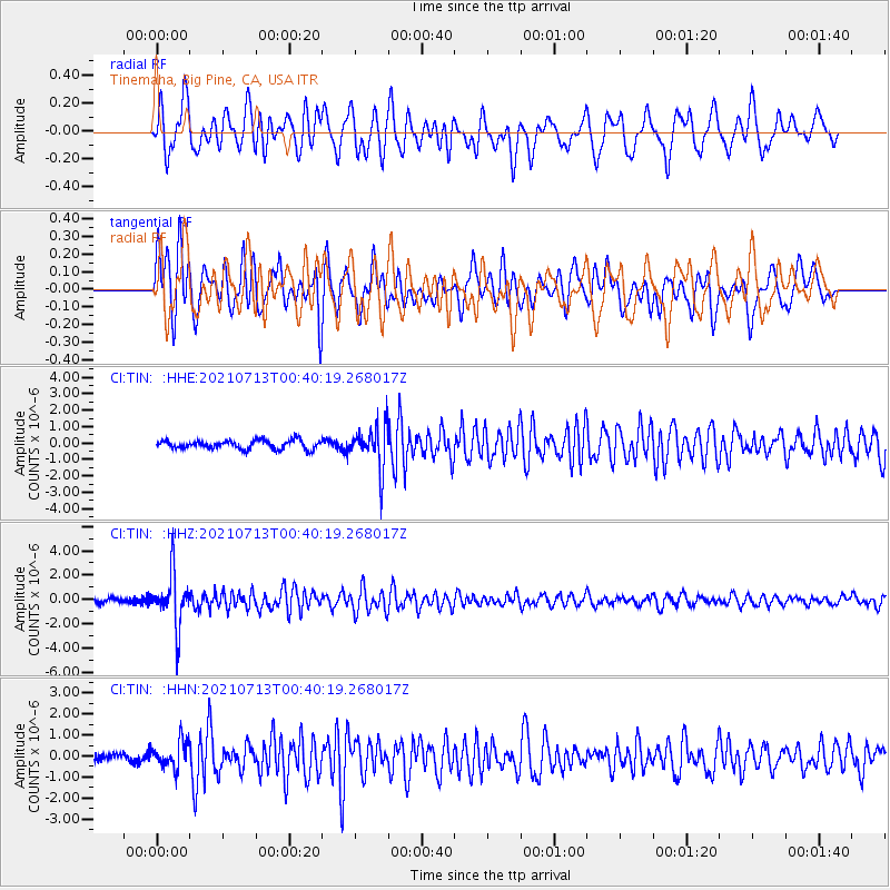
TIN Tinemaha, Big Pine, CA, USA - Earthquake Result Viewer
*The percent match for this event was below the threshold and hence no stack was calculated.
| Earthquake location: |
Kuril Islands |
| Earthquake latitude/longitude: |
46.2/151.7 |
| Earthquake time(UTC): |
2021/07/13 (194) 00:30:16 GMT |
| Earthquake Depth: |
33 km |
| Earthquake Magnitude: |
5.6 Mww |
| Earthquake Catalog/Contributor: |
NEIC PDE/us |
|
| Network: |
CI Caltech Regional Seismic Network |
| Station: |
TIN Tinemaha, Big Pine, CA, USA |
| Lat/Lon: |
37.05 N/118.23 W |
| Elevation: |
1197 m |
|
| Distance: |
64.5 deg |
| Az: |
62.409 deg |
| Baz: |
309.667 deg |
| Ray Param: |
$rayparam |
*The percent match for this event was below the threshold and hence was not used in the summary stack. |
|
| Radial Match: |
68.905396 % |
| Radial Bump: |
400 |
| Transverse Match: |
75.18535 % |
| Transverse Bump: |
400 |
| SOD ConfigId: |
25131211 |
| Insert Time: |
2021-07-27 00:40:58.322 +0000 |
| GWidth: |
2.5 |
| Max Bumps: |
400 |
| Tol: |
0.001 |
|
Signal To Noise
| Channel | StoN | STA | LTA |
| CI:TIN: :HHZ:20210713T00:40:19.268017Z | 13.618878 | 2.1013414E-6 | 1.5429622E-7 |
| CI:TIN: :HHN:20210713T00:40:19.268017Z | 2.8083868 | 6.397227E-7 | 2.277901E-7 |
| CI:TIN: :HHE:20210713T00:40:19.268017Z | 5.017841 | 1.3132668E-6 | 2.6171952E-7 |
| Arrivals |
| Ps | |
| PpPs | |
| PsPs/PpSs | |


