POGR XW.POGR - Earthquake Result Viewer
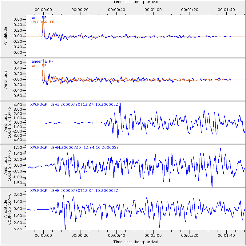
Earthquake location: Southeast Of Honshu, Japan
Earthquake latitude/longitude: 33.9/139.4
Earthquake time(UTC): 2000/07/30 (212) 12:25:45 GMT
Earthquake Depth: 10 km
Earthquake Magnitude: 6.0 MB, 6.5 MS, 6.5 MW, 6.5 MW
Earthquake Catalog/Contributor: WHDF/NEIC
Network: XW Tien Shan Continental Dynamics
Station: POGR XW.POGR
Lat/Lon: 41.02 N/75.55 E
Elevation: 2357 m
Distance: 50.2 deg
Az: 297.828 deg
Baz: 76.426 deg
Ray Param: 0.06823812
Estimated Moho Depth: 25.5 km
Estimated Crust Vp/Vs: 1.81
Assumed Crust Vp: 6.491 km/s
Estimated Crust Vs: 3.596 km/s
Estimated Crust Poisson's Ratio: 0.28
Radial Match: 94.94358 %
Radial Bump: 395
Transverse Match: 79.87293 %
Transverse Bump: 400
SOD ConfigId: 20082
Insert Time: 2010-02-26 15:44:58.391 +0000
GWidth: 2.5
Max Bumps: 400
Tol: 0.001

Signal To Noise

ChannelStoNSTALTA
XW:POGR: :BHN:20000730T12:34:10.200005Z1.21054098.947585E-87.391394E-8
XW:POGR: :BHE:20000730T12:34:10.200005Z1.65285129.560591E-85.7843025E-8
XW:POGR: :BHZ:20000730T12:34:10.200005Z3.5658692.2006137E-76.1713244E-8
Arrivals
Ps3.4 SECOND
PpPs10 SECOND
PsPs/PpSs14 SECOND