POGR XW.POGR - Earthquake Result Viewer
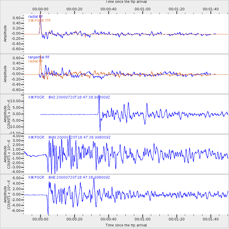
Earthquake location: Near East Coast Of Honshu, Japan
Earthquake latitude/longitude: 36.5/141.0
Earthquake time(UTC): 2000/07/20 (202) 18:39:18 GMT
Earthquake Depth: 47 km
Earthquake Magnitude: 6.1 MB, 5.4 MS, 6.1 ME, 6.0 MW
Earthquake Catalog/Contributor: WHDF/NEIC
Network: XW Tien Shan Continental Dynamics
Station: POGR XW.POGR
Lat/Lon: 41.02 N/75.55 E
Elevation: 2357 m
Distance: 50.2 deg
Az: 296.317 deg
Baz: 72.627 deg
Ray Param: 0.06812948
Estimated Moho Depth: 51.75 km
Estimated Crust Vp/Vs: 1.81
Assumed Crust Vp: 6.491 km/s
Estimated Crust Vs: 3.586 km/s
Estimated Crust Poisson's Ratio: 0.28
Radial Match: 96.248474 %
Radial Bump: 400
Transverse Match: 73.83796 %
Transverse Bump: 400
SOD ConfigId: 20082
Insert Time: 2010-02-26 15:45:00.020 +0000
GWidth: 2.5
Max Bumps: 400
Tol: 0.001

Signal To Noise

ChannelStoNSTALTA
XW:POGR: :BHN:20000720T18:47:38.998009Z1.59084781.0134509E-66.3705073E-7
XW:POGR: :BHE:20000720T18:47:38.998009Z73.152541.8768952E-62.565728E-8
XW:POGR: :BHZ:20000720T18:47:38.998009Z55.9667433.8694598E-66.913855E-8
Arrivals
Ps6.8 SECOND
PpPs21 SECOND
PsPs/PpSs28 SECOND