
POGR XW.POGR - Earthquake Result Viewer
| ||||||||||||||||||
| ||||||||||||||||||
| ||||||||||||||||||
|
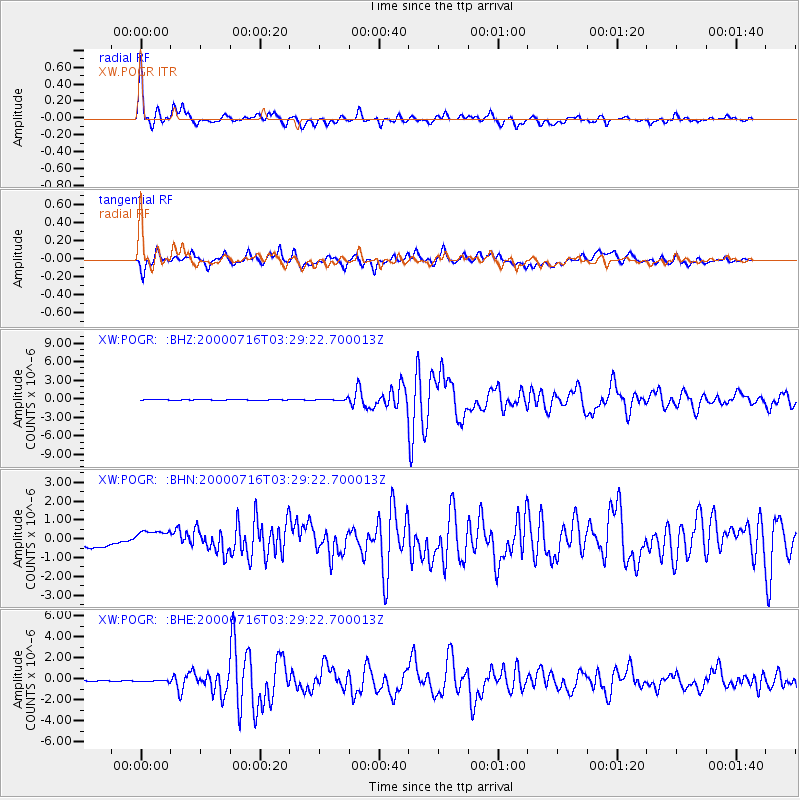
Signal To Noise
| Channel | StoN | STA | LTA |
| XW:POGR: :BHN:20000716T03:29:22.700013Z | 1.4971995 | 4.812397E-7 | 3.2142657E-7 |
| XW:POGR: :BHE:20000716T03:29:22.700013Z | 1.6798782 | 7.200375E-8 | 4.2862485E-8 |
| XW:POGR: :BHZ:20000716T03:29:22.700013Z | 1.9871758 | 1.231961E-7 | 6.199557E-8 |
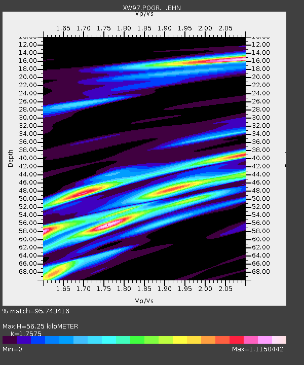
| Arrivals | |
| Ps | 7.0 SECOND |
| PpPs | 22 SECOND |
| PsPs/PpSs | 29 SECOND |

