You are here: Home > Network List > UU - University of Utah Regional Network Stations List
> Station CCUT Cedar City, UT, USA > Earthquake Result Viewer
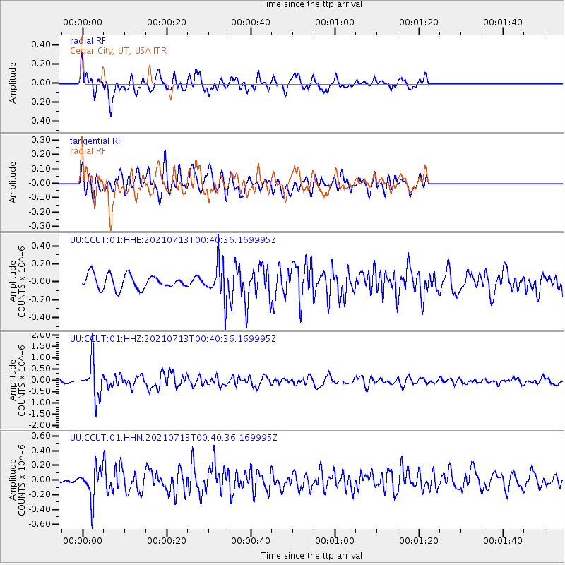
CCUT Cedar City, UT, USA - Earthquake Result Viewer
*The percent match for this event was below the threshold and hence no stack was calculated.
| Earthquake location: |
Kuril Islands |
| Earthquake latitude/longitude: |
46.2/151.7 |
| Earthquake time(UTC): |
2021/07/13 (194) 00:30:16 GMT |
| Earthquake Depth: |
33 km |
| Earthquake Magnitude: |
5.6 Mww |
| Earthquake Catalog/Contributor: |
NEIC PDE/us |
|
| Network: |
UU University of Utah Regional Network |
| Station: |
CCUT Cedar City, UT, USA |
| Lat/Lon: |
37.55 N/113.36 W |
| Elevation: |
2127 m |
|
| Distance: |
67.1 deg |
| Az: |
59.234 deg |
| Baz: |
311.304 deg |
| Ray Param: |
$rayparam |
*The percent match for this event was below the threshold and hence was not used in the summary stack. |
|
| Radial Match: |
63.982822 % |
| Radial Bump: |
400 |
| Transverse Match: |
74.50918 % |
| Transverse Bump: |
400 |
| SOD ConfigId: |
25131211 |
| Insert Time: |
2021-07-27 01:04:10.497 +0000 |
| GWidth: |
2.5 |
| Max Bumps: |
400 |
| Tol: |
0.001 |
|
Signal To Noise
| Channel | StoN | STA | LTA |
| UU:CCUT:01:HHZ:20210713T00:40:36.169995Z | 13.48713 | 7.7399216E-7 | 5.738746E-8 |
| UU:CCUT:01:HHN:20210713T00:40:36.169995Z | 3.8204827 | 2.1525767E-7 | 5.6343055E-8 |
| UU:CCUT:01:HHE:20210713T00:40:36.169995Z | 2.5984745 | 2.0150341E-7 | 7.754681E-8 |
| Arrivals |
| Ps | |
| PpPs | |
| PsPs/PpSs | |


