POGR XW.POGR - Earthquake Result Viewer
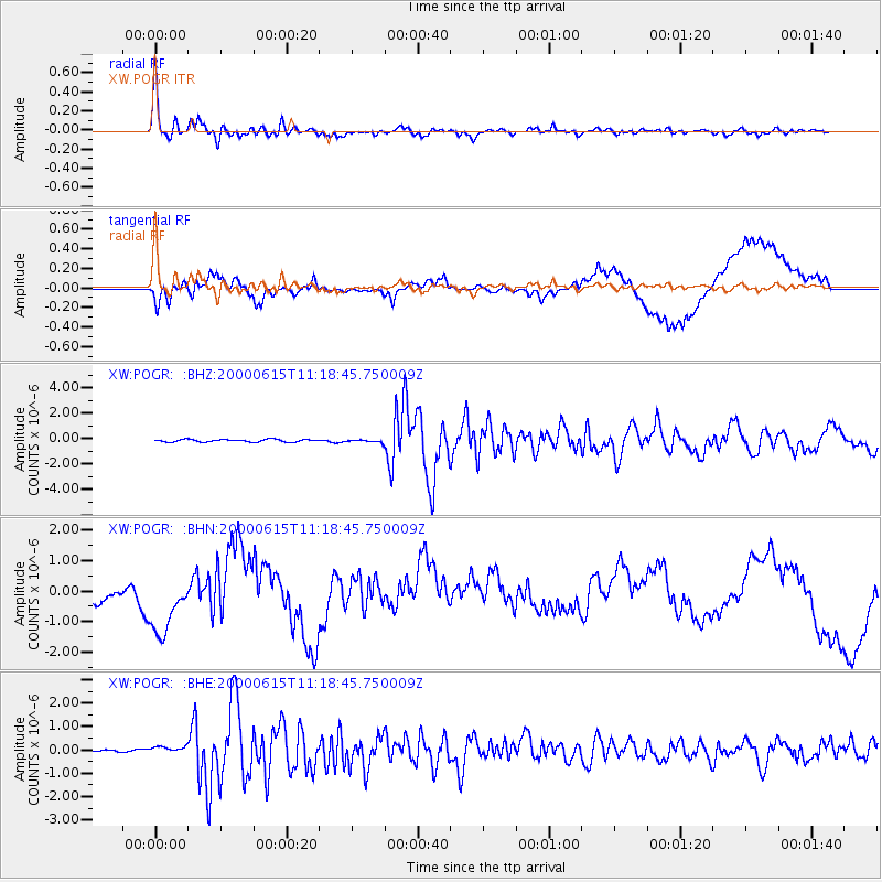
Earthquake location: Southeast Of Shikoku, Japan
Earthquake latitude/longitude: 29.4/132.1
Earthquake time(UTC): 2000/06/15 (167) 11:10:46 GMT
Earthquake Depth: 10 km
Earthquake Magnitude: 6.0 MB, 5.6 MS, 6.1 MW, 6.1 MW
Earthquake Catalog/Contributor: WHDF/NEIC
Network: XW Tien Shan Continental Dynamics
Station: POGR XW.POGR
Lat/Lon: 41.02 N/75.55 E
Elevation: 2357 m
Distance: 46.9 deg
Az: 300.18 deg
Baz: 85.721 deg
Ray Param: 0.07034652
Estimated Moho Depth: 46.5 km
Estimated Crust Vp/Vs: 1.87
Assumed Crust Vp: 6.491 km/s
Estimated Crust Vs: 3.466 km/s
Estimated Crust Poisson's Ratio: 0.30
Radial Match: 93.863464 %
Radial Bump: 400
Transverse Match: 72.11044 %
Transverse Bump: 400
SOD ConfigId: 20082
Insert Time: 2010-02-26 15:45:14.291 +0000
GWidth: 2.5
Max Bumps: 400
Tol: 0.001

Signal To Noise

ChannelStoNSTALTA
XW:POGR: :BHN:20000615T11:18:45.750009Z3.2007891.1860419E-63.7054673E-7
XW:POGR: :BHE:20000615T11:18:45.750009Z2.72258191.6402906E-76.024761E-8
XW:POGR: :BHZ:20000615T11:18:45.750009Z1.07269721.0949721E-71.02076534E-7
Arrivals
Ps6.6 SECOND
PpPs19 SECOND
PsPs/PpSs26 SECOND