You are here: Home > Network List > UW - Pacific Northwest Regional Seismic Network Stations List
> Station IRON Crane, OR, USA > Earthquake Result Viewer
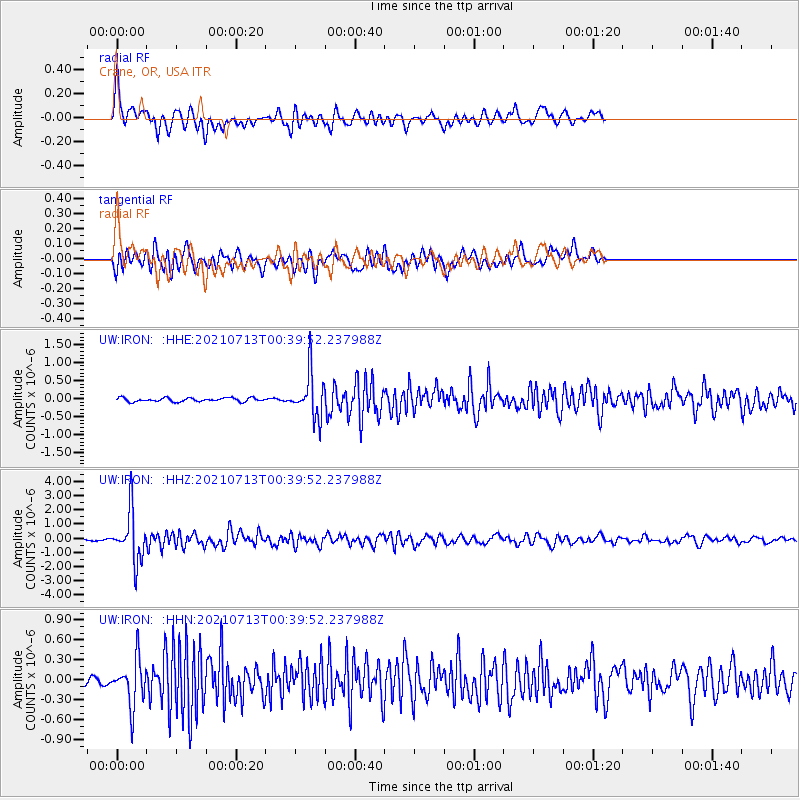
IRON Crane, OR, USA - Earthquake Result Viewer
*The percent match for this event was below the threshold and hence no stack was calculated.
| Earthquake location: |
Kuril Islands |
| Earthquake latitude/longitude: |
46.2/151.7 |
| Earthquake time(UTC): |
2021/07/13 (194) 00:30:16 GMT |
| Earthquake Depth: |
33 km |
| Earthquake Magnitude: |
5.6 Mww |
| Earthquake Catalog/Contributor: |
NEIC PDE/us |
|
| Network: |
UW Pacific Northwest Regional Seismic Network |
| Station: |
IRON Crane, OR, USA |
| Lat/Lon: |
43.36 N/118.47 W |
| Elevation: |
1226 m |
|
| Distance: |
60.5 deg |
| Az: |
56.971 deg |
| Baz: |
306.994 deg |
| Ray Param: |
$rayparam |
*The percent match for this event was below the threshold and hence was not used in the summary stack. |
|
| Radial Match: |
79.439606 % |
| Radial Bump: |
400 |
| Transverse Match: |
67.16474 % |
| Transverse Bump: |
400 |
| SOD ConfigId: |
25131211 |
| Insert Time: |
2021-07-27 01:05:42.634 +0000 |
| GWidth: |
2.5 |
| Max Bumps: |
400 |
| Tol: |
0.001 |
|
Signal To Noise
| Channel | StoN | STA | LTA |
| UW:IRON: :HHZ:20210713T00:39:52.237988Z | 21.215084 | 1.7038301E-6 | 8.0312205E-8 |
| UW:IRON: :HHN:20210713T00:39:52.237988Z | 4.6629357 | 3.4571968E-7 | 7.414206E-8 |
| UW:IRON: :HHE:20210713T00:39:52.237988Z | 11.655009 | 6.029214E-7 | 5.1730662E-8 |
| Arrivals |
| Ps | |
| PpPs | |
| PsPs/PpSs | |


