POGR XW.POGR - Earthquake Result Viewer
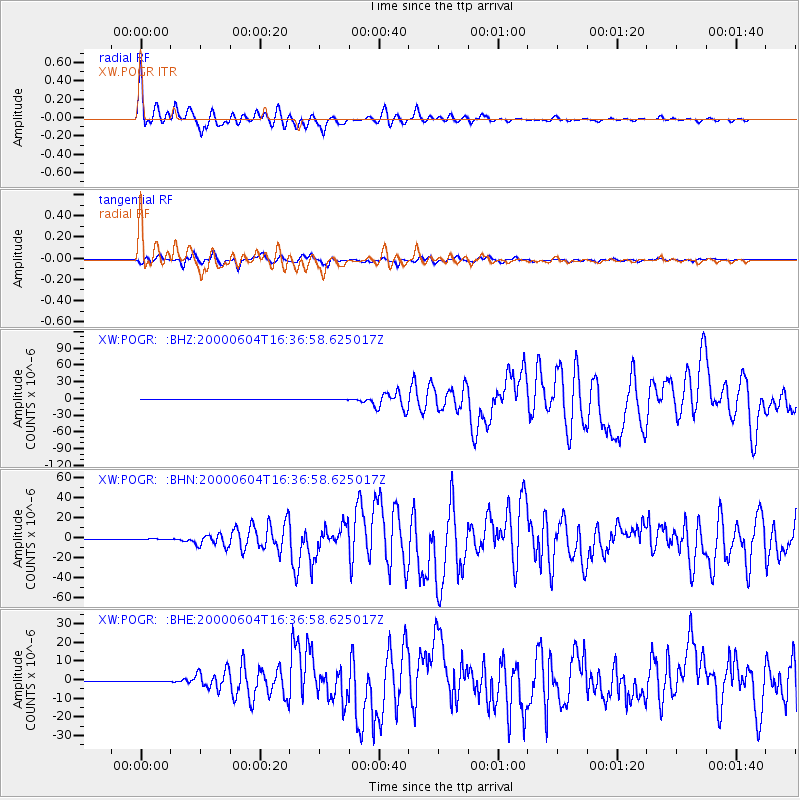
Earthquake location: Southern Sumatra, Indonesia
Earthquake latitude/longitude: -4.7/102.1
Earthquake time(UTC): 2000/06/04 (156) 16:28:26 GMT
Earthquake Depth: 33 km
Earthquake Magnitude: 6.8 MB, 8.0 MS, 7.9 MW, 7.7 MW
Earthquake Catalog/Contributor: WHDF/NEIC
Network: XW Tien Shan Continental Dynamics
Station: POGR XW.POGR
Lat/Lon: 41.02 N/75.55 E
Elevation: 2357 m
Distance: 51.6 deg
Az: 334.443 deg
Baz: 145.373 deg
Ray Param: 0.06724987
Estimated Moho Depth: 19.25 km
Estimated Crust Vp/Vs: 1.79
Assumed Crust Vp: 6.491 km/s
Estimated Crust Vs: 3.621 km/s
Estimated Crust Poisson's Ratio: 0.27
Radial Match: 95.240425 %
Radial Bump: 400
Transverse Match: 89.809135 %
Transverse Bump: 400
SOD ConfigId: 20082
Insert Time: 2010-02-26 15:45:25.736 +0000
GWidth: 2.5
Max Bumps: 400
Tol: 0.001

Signal To Noise

ChannelStoNSTALTA
XW:POGR: :BHN:20000604T16:36:58.625017Z0.8069684.5574075E-75.647569E-7
XW:POGR: :BHE:20000604T16:36:58.625017Z0.290447653.6327908E-81.2507559E-7
XW:POGR: :BHZ:20000604T16:36:58.625017Z0.623268541.464935E-72.3504074E-7
Arrivals
Ps2.5 SECOND
PpPs7.8 SECOND
PsPs/PpSs10 SECOND