You are here: Home > Network List > GS - US Geological Survey Networks Stations List
> Station OK051 E0350 and S34600 Roads, Ralston, OK > Earthquake Result Viewer
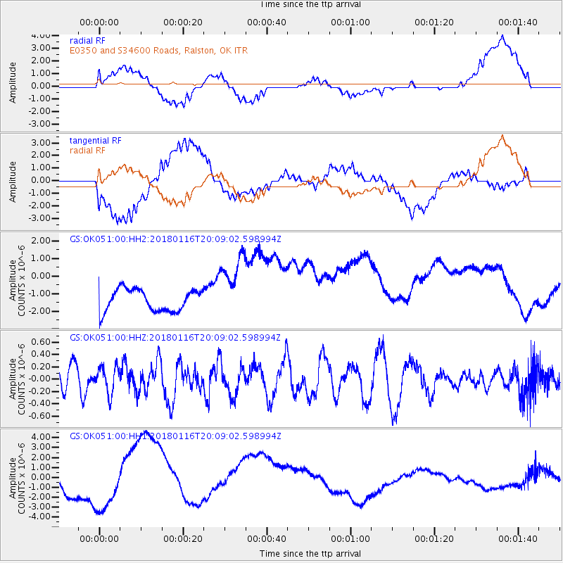
OK051 E0350 and S34600 Roads, Ralston, OK - Earthquake Result Viewer
*The percent match for this event was below the threshold and hence no stack was calculated.
| Earthquake location: |
Fiji Islands Region |
| Earthquake latitude/longitude: |
-19.5/-179.3 |
| Earthquake time(UTC): |
2018/01/16 (016) 19:57:18 GMT |
| Earthquake Depth: |
666 km |
| Earthquake Magnitude: |
5.9 Mww |
| Earthquake Catalog/Contributor: |
NEIC PDE/us |
|
| Network: |
GS US Geological Survey Networks |
| Station: |
OK051 E0350 and S34600 Roads, Ralston, OK |
| Lat/Lon: |
36.51 N/96.84 W |
| Elevation: |
263 m |
|
| Distance: |
95.5 deg |
| Az: |
53.362 deg |
| Baz: |
250.013 deg |
| Ray Param: |
$rayparam |
*The percent match for this event was below the threshold and hence was not used in the summary stack. |
|
| Radial Match: |
48.318207 % |
| Radial Bump: |
400 |
| Transverse Match: |
46.56228 % |
| Transverse Bump: |
400 |
| SOD ConfigId: |
2546091 |
| Insert Time: |
2018-01-30 19:58:28.250 +0000 |
| GWidth: |
2.5 |
| Max Bumps: |
400 |
| Tol: |
0.001 |
|
Signal To Noise
| Channel | StoN | STA | LTA |
| GS:OK051:00:HHZ:20180116T20:09:02.598994Z | 1.0880815 | 2.2128465E-7 | 2.033714E-7 |
| GS:OK051:00:HH1:20180116T20:09:02.598994Z | 0.88204396 | 1.5517147E-6 | 1.759226E-6 |
| GS:OK051:00:HH2:20180116T20:09:02.598994Z | 3.0469632 | 1.8931993E-6 | 6.213397E-7 |
| Arrivals |
| Ps | |
| PpPs | |
| PsPs/PpSs | |


