You are here: Home > Network List > IW - Intermountain West Stations List
> Station PLID Pearl Lake, Idaho, USA > Earthquake Result Viewer
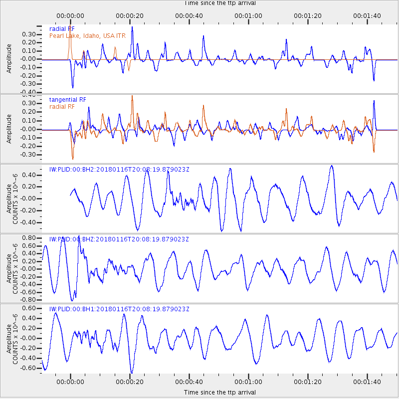
PLID Pearl Lake, Idaho, USA - Earthquake Result Viewer
*The percent match for this event was below the threshold and hence no stack was calculated.
| Earthquake location: |
Fiji Islands Region |
| Earthquake latitude/longitude: |
-19.5/-179.3 |
| Earthquake time(UTC): |
2018/01/16 (016) 19:57:18 GMT |
| Earthquake Depth: |
666 km |
| Earthquake Magnitude: |
5.9 Mww |
| Earthquake Catalog/Contributor: |
NEIC PDE/us |
|
| Network: |
IW Intermountain West |
| Station: |
PLID Pearl Lake, Idaho, USA |
| Lat/Lon: |
45.09 N/116.00 W |
| Elevation: |
2164 m |
|
| Distance: |
86.2 deg |
| Az: |
39.358 deg |
| Baz: |
237.643 deg |
| Ray Param: |
$rayparam |
*The percent match for this event was below the threshold and hence was not used in the summary stack. |
|
| Radial Match: |
64.33758 % |
| Radial Bump: |
400 |
| Transverse Match: |
47.46037 % |
| Transverse Bump: |
400 |
| SOD ConfigId: |
2546091 |
| Insert Time: |
2018-01-30 19:59:13.899 +0000 |
| GWidth: |
2.5 |
| Max Bumps: |
400 |
| Tol: |
0.001 |
|
Signal To Noise
| Channel | StoN | STA | LTA |
| IW:PLID:00:BHZ:20180116T20:08:19.879023Z | 1.9050435 | 5.661422E-7 | 2.9718072E-7 |
| IW:PLID:00:BH1:20180116T20:08:19.879023Z | 0.635887 | 1.7948584E-7 | 2.8226057E-7 |
| IW:PLID:00:BH2:20180116T20:08:19.879023Z | 1.128748 | 2.3718736E-7 | 2.1013314E-7 |
| Arrivals |
| Ps | |
| PpPs | |
| PsPs/PpSs | |


