
POGR XW.POGR - Earthquake Result Viewer
| ||||||||||||||||||
| ||||||||||||||||||
| ||||||||||||||||||
|
Signal To Noise
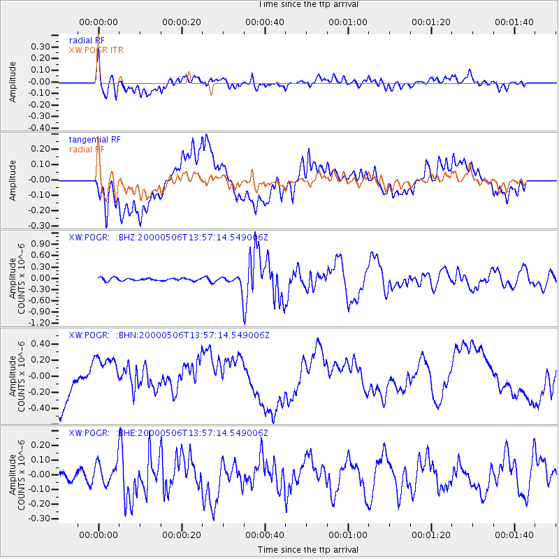
| Channel | StoN | STA | LTA |
| XW:POGR: :BHN:20000506T13:57:14.549006Z | 1.0038106 | 2.1665606E-7 | 2.1583361E-7 |
| XW:POGR: :BHE:20000506T13:57:14.549006Z | 1.99777 | 8.181169E-8 | 4.095151E-8 |
| XW:POGR: :BHZ:20000506T13:57:14.549006Z | 5.5006127 | 1.9263564E-7 | 3.502076E-8 |
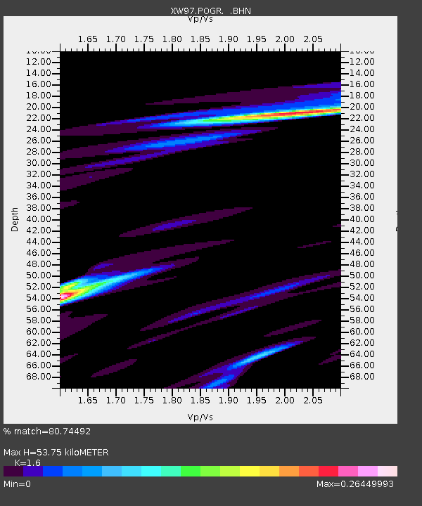
| Arrivals | |
| Ps | 5.1 SECOND |
| PpPs | 21 SECOND |
| PsPs/PpSs | 26 SECOND |

