
POGR XW.POGR - Earthquake Result Viewer
| ||||||||||||||||||
| ||||||||||||||||||
| ||||||||||||||||||
|
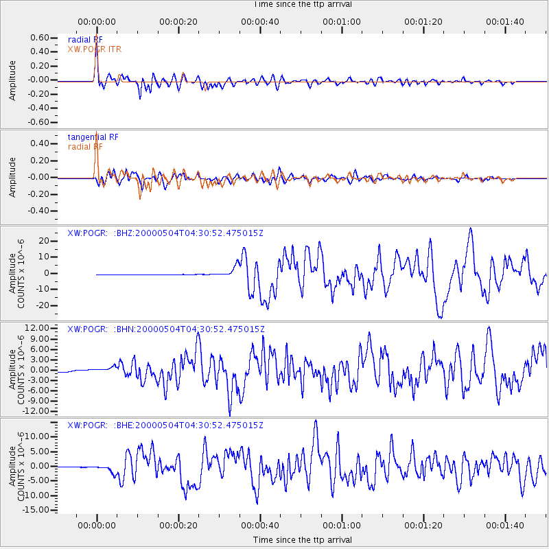
Signal To Noise
| Channel | StoN | STA | LTA |
| XW:POGR: :BHN:20000504T04:30:52.475015Z | 2.6338973 | 8.91765E-7 | 3.3857245E-7 |
| XW:POGR: :BHE:20000504T04:30:52.475015Z | 51.247925 | 1.4242108E-6 | 2.7790605E-8 |
| XW:POGR: :BHZ:20000504T04:30:52.475015Z | 82.92837 | 3.5762343E-6 | 4.3124377E-8 |
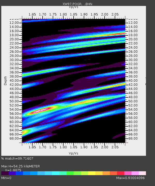
| Arrivals | |
| Ps | 6.0 SECOND |
| PpPs | 21 SECOND |
| PsPs/PpSs | 27 SECOND |

