You are here: Home > Network List > US - United States National Seismic Network Stations List
> Station EGMT Eagleton, Montana, USA > Earthquake Result Viewer
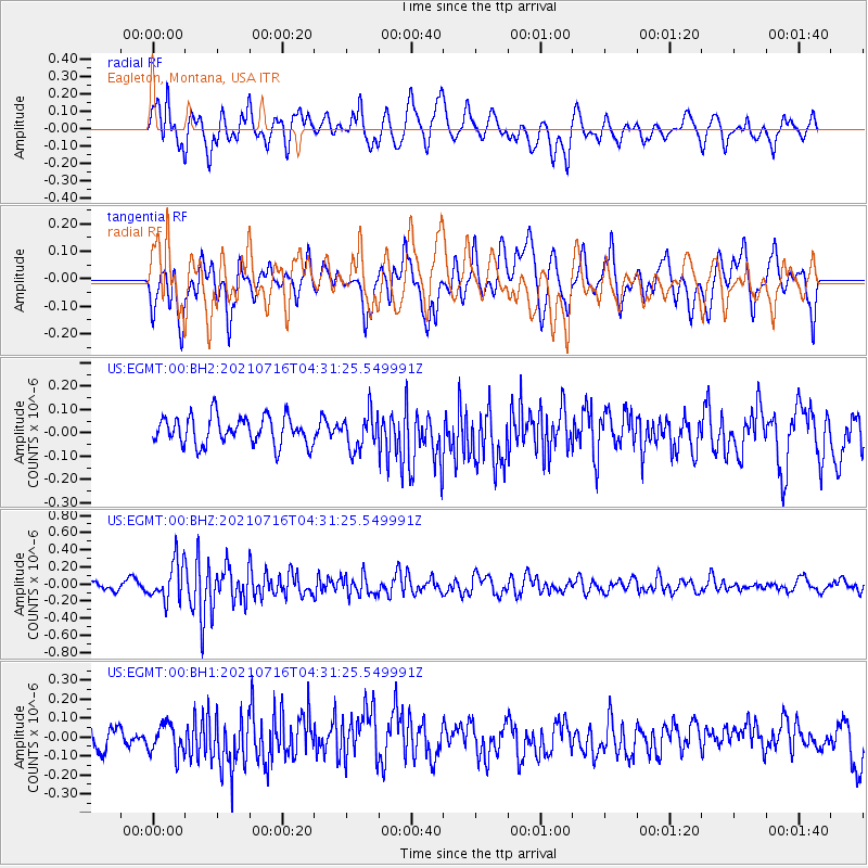
EGMT Eagleton, Montana, USA - Earthquake Result Viewer
*The percent match for this event was below the threshold and hence no stack was calculated.
| Earthquake location: |
Southeast Of Honshu, Japan |
| Earthquake latitude/longitude: |
33.3/139.5 |
| Earthquake time(UTC): |
2021/07/16 (197) 04:19:58 GMT |
| Earthquake Depth: |
11 km |
| Earthquake Magnitude: |
5.5 Mww |
| Earthquake Catalog/Contributor: |
NEIC PDE/us |
|
| Network: |
US United States National Seismic Network |
| Station: |
EGMT Eagleton, Montana, USA |
| Lat/Lon: |
48.02 N/109.75 W |
| Elevation: |
1055 m |
|
| Distance: |
78.1 deg |
| Az: |
39.905 deg |
| Baz: |
306.844 deg |
| Ray Param: |
$rayparam |
*The percent match for this event was below the threshold and hence was not used in the summary stack. |
|
| Radial Match: |
64.928505 % |
| Radial Bump: |
400 |
| Transverse Match: |
58.45509 % |
| Transverse Bump: |
400 |
| SOD ConfigId: |
25131211 |
| Insert Time: |
2021-07-30 04:41:00.236 +0000 |
| GWidth: |
2.5 |
| Max Bumps: |
400 |
| Tol: |
0.001 |
|
Signal To Noise
| Channel | StoN | STA | LTA |
| US:EGMT:00:BHZ:20210716T04:31:25.549991Z | 4.291411 | 2.2773295E-7 | 5.306715E-8 |
| US:EGMT:00:BH1:20210716T04:31:25.549991Z | 1.5010372 | 7.824713E-8 | 5.212871E-8 |
| US:EGMT:00:BH2:20210716T04:31:25.549991Z | 1.231102 | 7.4139265E-8 | 6.022187E-8 |
| Arrivals |
| Ps | |
| PpPs | |
| PsPs/PpSs | |


