You are here: Home > Network List > US - United States National Seismic Network Stations List
> Station MSO Missoula, Montana, USA > Earthquake Result Viewer
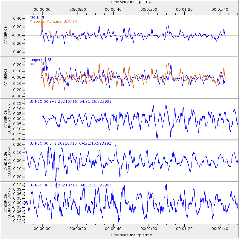
MSO Missoula, Montana, USA - Earthquake Result Viewer
*The percent match for this event was below the threshold and hence no stack was calculated.
| Earthquake location: |
Southeast Of Honshu, Japan |
| Earthquake latitude/longitude: |
33.3/139.5 |
| Earthquake time(UTC): |
2021/07/16 (197) 04:19:58 GMT |
| Earthquake Depth: |
11 km |
| Earthquake Magnitude: |
5.5 Mww |
| Earthquake Catalog/Contributor: |
NEIC PDE/us |
|
| Network: |
US United States National Seismic Network |
| Station: |
MSO Missoula, Montana, USA |
| Lat/Lon: |
46.83 N/113.94 W |
| Elevation: |
1264 m |
|
| Distance: |
76.5 deg |
| Az: |
42.597 deg |
| Baz: |
304.362 deg |
| Ray Param: |
$rayparam |
*The percent match for this event was below the threshold and hence was not used in the summary stack. |
|
| Radial Match: |
64.543495 % |
| Radial Bump: |
400 |
| Transverse Match: |
60.94669 % |
| Transverse Bump: |
400 |
| SOD ConfigId: |
25131211 |
| Insert Time: |
2021-07-30 04:41:09.918 +0000 |
| GWidth: |
2.5 |
| Max Bumps: |
400 |
| Tol: |
0.001 |
|
Signal To Noise
| Channel | StoN | STA | LTA |
| US:MSO:00:BHZ:20210716T04:31:16.52399Z | 1.7382994 | 1.0432283E-7 | 6.00143E-8 |
| US:MSO:00:BH1:20210716T04:31:16.52399Z | 0.64545286 | 3.1719157E-8 | 4.914249E-8 |
| US:MSO:00:BH2:20210716T04:31:16.52399Z | 0.67632955 | 2.1919034E-8 | 3.2408806E-8 |
| Arrivals |
| Ps | |
| PpPs | |
| PsPs/PpSs | |


