You are here: Home > Network List > UW - Pacific Northwest Regional Seismic Network Stations List
> Station UMAT Pilot Rock, OR, USA > Earthquake Result Viewer
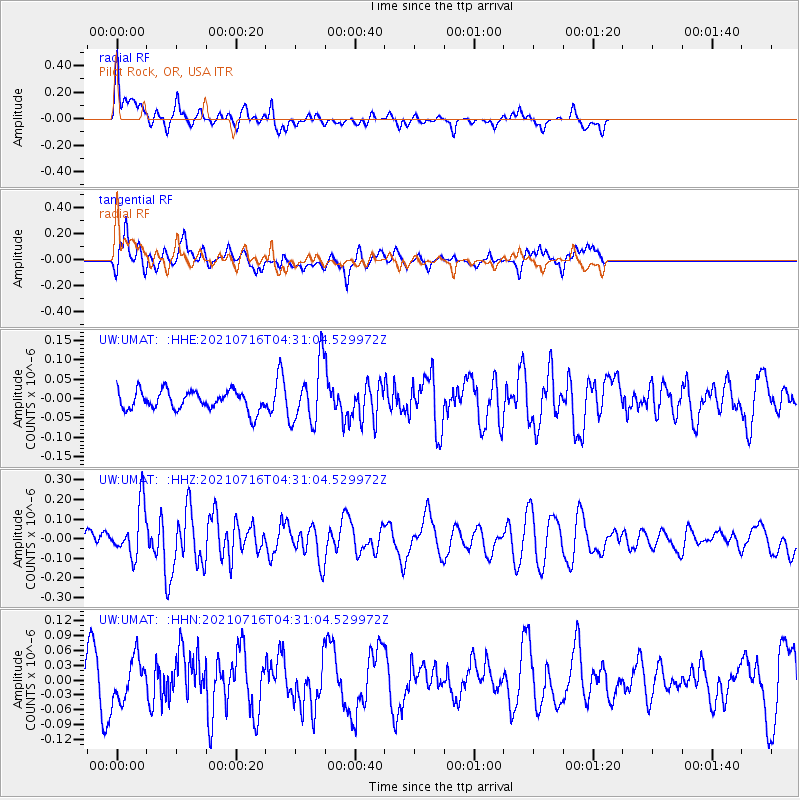
UMAT Pilot Rock, OR, USA - Earthquake Result Viewer
*The percent match for this event was below the threshold and hence no stack was calculated.
| Earthquake location: |
Southeast Of Honshu, Japan |
| Earthquake latitude/longitude: |
33.3/139.5 |
| Earthquake time(UTC): |
2021/07/16 (197) 04:19:58 GMT |
| Earthquake Depth: |
11 km |
| Earthquake Magnitude: |
5.5 Mww |
| Earthquake Catalog/Contributor: |
NEIC PDE/us |
|
| Network: |
UW Pacific Northwest Regional Seismic Network |
| Station: |
UMAT Pilot Rock, OR, USA |
| Lat/Lon: |
45.29 N/118.96 W |
| Elevation: |
1318 m |
|
| Distance: |
74.4 deg |
| Az: |
45.895 deg |
| Baz: |
301.587 deg |
| Ray Param: |
$rayparam |
*The percent match for this event was below the threshold and hence was not used in the summary stack. |
|
| Radial Match: |
61.576283 % |
| Radial Bump: |
400 |
| Transverse Match: |
54.842056 % |
| Transverse Bump: |
400 |
| SOD ConfigId: |
25131211 |
| Insert Time: |
2021-07-30 04:42:47.099 +0000 |
| GWidth: |
2.5 |
| Max Bumps: |
400 |
| Tol: |
0.001 |
|
Signal To Noise
| Channel | StoN | STA | LTA |
| UW:UMAT: :HHZ:20210716T04:31:04.529972Z | 3.283014 | 1.323564E-7 | 4.0315516E-8 |
| UW:UMAT: :HHN:20210716T04:31:04.529972Z | 0.76064116 | 4.326822E-8 | 5.6883877E-8 |
| UW:UMAT: :HHE:20210716T04:31:04.529972Z | 2.9851453 | 7.5550055E-8 | 2.530867E-8 |
| Arrivals |
| Ps | |
| PpPs | |
| PsPs/PpSs | |


