You are here: Home > Network List > WY - Yellowstone Wyoming Seismic Network Stations List
> Station YHH Holmes Hill, YNP, WY, USA > Earthquake Result Viewer
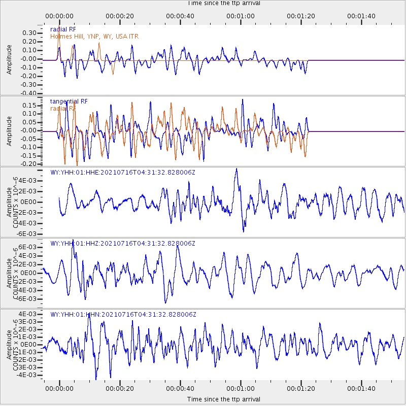
YHH Holmes Hill, YNP, WY, USA - Earthquake Result Viewer
*The percent match for this event was below the threshold and hence no stack was calculated.
| Earthquake location: |
Southeast Of Honshu, Japan |
| Earthquake latitude/longitude: |
33.3/139.5 |
| Earthquake time(UTC): |
2021/07/16 (197) 04:19:58 GMT |
| Earthquake Depth: |
11 km |
| Earthquake Magnitude: |
5.5 Mww |
| Earthquake Catalog/Contributor: |
NEIC PDE/us |
|
| Network: |
WY Yellowstone Wyoming Seismic Network |
| Station: |
YHH Holmes Hill, YNP, WY, USA |
| Lat/Lon: |
44.79 N/110.85 W |
| Elevation: |
2717 m |
|
| Distance: |
79.4 deg |
| Az: |
43.012 deg |
| Baz: |
306.657 deg |
| Ray Param: |
$rayparam |
*The percent match for this event was below the threshold and hence was not used in the summary stack. |
|
| Radial Match: |
57.368454 % |
| Radial Bump: |
400 |
| Transverse Match: |
64.29538 % |
| Transverse Bump: |
400 |
| SOD ConfigId: |
25131211 |
| Insert Time: |
2021-07-30 04:43:15.425 +0000 |
| GWidth: |
2.5 |
| Max Bumps: |
400 |
| Tol: |
0.001 |
|
Signal To Noise
| Channel | StoN | STA | LTA |
| WY:YHH:01:HHZ:20210716T04:31:32.828006Z | 1.901029 | 3.410246E-9 | 1.7938949E-9 |
| WY:YHH:01:HHN:20210716T04:31:32.828006Z | 0.8639514 | 7.214861E-10 | 8.351003E-10 |
| WY:YHH:01:HHE:20210716T04:31:32.828006Z | 0.9628801 | 1.2172274E-9 | 1.2641527E-9 |
| Arrivals |
| Ps | |
| PpPs | |
| PsPs/PpSs | |


