You are here: Home > Network List > AV - Alaska Volcano Observatory Stations List
> Station AMKA Regional Station, Amchitka Island, Alaska > Earthquake Result Viewer
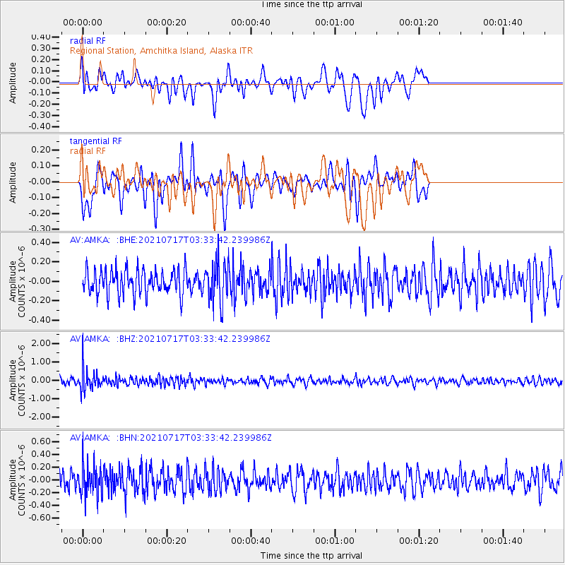
AMKA Regional Station, Amchitka Island, Alaska - Earthquake Result Viewer
*The percent match for this event was below the threshold and hence no stack was calculated.
| Earthquake location: |
Fiji Islands Region |
| Earthquake latitude/longitude: |
-20.6/-178.4 |
| Earthquake time(UTC): |
2021/07/17 (198) 03:23:47 GMT |
| Earthquake Depth: |
559 km |
| Earthquake Magnitude: |
5.5 Mww |
| Earthquake Catalog/Contributor: |
NEIC PDE/us |
|
| Network: |
AV Alaska Volcano Observatory |
| Station: |
AMKA Regional Station, Amchitka Island, Alaska |
| Lat/Lon: |
51.38 N/179.30 E |
| Elevation: |
116 m |
|
| Distance: |
71.7 deg |
| Az: |
358.47 deg |
| Baz: |
177.714 deg |
| Ray Param: |
$rayparam |
*The percent match for this event was below the threshold and hence was not used in the summary stack. |
|
| Radial Match: |
44.840927 % |
| Radial Bump: |
400 |
| Transverse Match: |
50.356033 % |
| Transverse Bump: |
400 |
| SOD ConfigId: |
25131211 |
| Insert Time: |
2021-07-31 03:29:03.590 +0000 |
| GWidth: |
2.5 |
| Max Bumps: |
400 |
| Tol: |
0.001 |
|
Signal To Noise
| Channel | StoN | STA | LTA |
| AV:AMKA: :BHZ:20210717T03:33:42.239986Z | 4.3980246 | 5.8781893E-7 | 1.3365522E-7 |
| AV:AMKA: :BHN:20210717T03:33:42.239986Z | 2.1070783 | 2.4736033E-7 | 1.1739494E-7 |
| AV:AMKA: :BHE:20210717T03:33:42.239986Z | 1.6935081 | 2.1120627E-7 | 1.2471524E-7 |
| Arrivals |
| Ps | |
| PpPs | |
| PsPs/PpSs | |


