
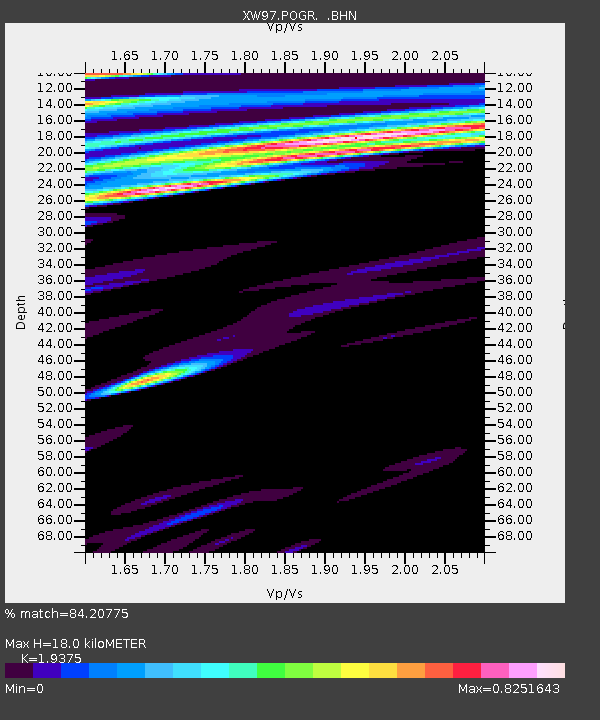
POGR XW.POGR - Earthquake Result Viewer
| ||||||||||||||||||
| ||||||||||||||||||
| ||||||||||||||||||
|
Signal To Noise
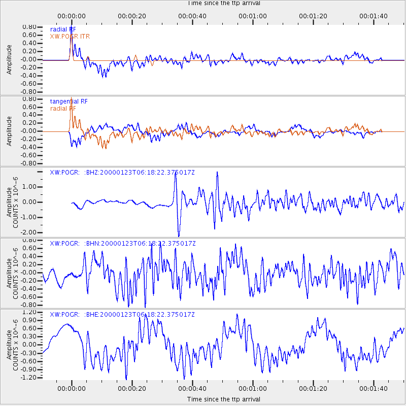
| Channel | StoN | STA | LTA |
| XW:POGR: :BHN:20000123T06:18:22.375017Z | 0.9574504 | 1.6158461E-7 | 1.6876551E-7 |
| XW:POGR: :BHE:20000123T06:18:22.375017Z | 1.4721119 | 5.856999E-7 | 3.978637E-7 |
| XW:POGR: :BHZ:20000123T06:18:22.375017Z | 4.5082273 | 6.293328E-7 | 1.3959652E-7 |
| Arrivals | |
| Ps | 2.7 SECOND |
| PpPs | 7.8 SECOND |
| PsPs/PpSs | 11 SECOND |

