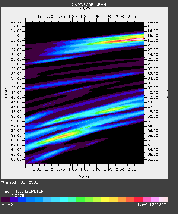
POGR XW.POGR - Earthquake Result Viewer
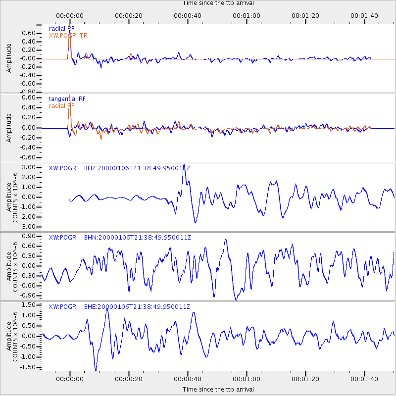
Earthquake location: Luzon, Philippines
Earthquake latitude/longitude: 16.1/119.5
Earthquake time(UTC): 2000/01/06 (006) 21:31:06 GMT
Earthquake Depth: 33 km
Earthquake Magnitude: 5.8 MB, 5.9 MS, 6.3 MW, 6.2 MW
Earthquake Catalog/Contributor: WHDF/NEIC
Network: XW Tien Shan Continental Dynamics
Station: POGR XW.POGR
Lat/Lon: 41.02 N/75.55 E
Elevation: 2357 m
Distance: 45.3 deg
Az: 312.338 deg
Baz: 110.103 deg
Ray Param: 0.07133113
Estimated Moho Depth: 17.0 km
Estimated Crust Vp/Vs: 2.10
Assumed Crust Vp: 6.491 km/s
Estimated Crust Vs: 3.095 km/s
Estimated Crust Poisson's Ratio: 0.35
Radial Match: 85.40533 %
Radial Bump: 400
Transverse Match: 74.5829 %
Transverse Bump: 400
SOD ConfigId: 3744
Insert Time: 2010-02-26 15:45:57.070 +0000
GWidth: 2.5
Max Bumps: 400
Tol: 0.001

Signal To Noise

ChannelStoNSTALTA
XW:POGR: :BHN:20000106T21:38:49.950011Z1.53749723.1343328E-72.0385943E-7
XW:POGR: :BHE:20000106T21:38:49.950011Z0.91547051.6263202E-71.7764857E-7
XW:POGR: :BHZ:20000106T21:38:49.950011Z1.59308672.6275825E-71.6493655E-7
Arrivals
Ps3.0 SECOND
PpPs7.7 SECOND
PsPs/PpSs11 SECOND