You are here: Home > Network List > CI - Caltech Regional Seismic Network Stations List
> Station DGR Domenigoni Reservoir, California, USA > Earthquake Result Viewer
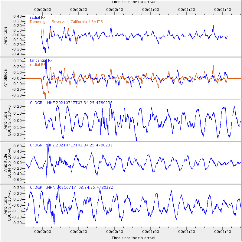
DGR Domenigoni Reservoir, California, USA - Earthquake Result Viewer
*The percent match for this event was below the threshold and hence no stack was calculated.
| Earthquake location: |
Fiji Islands Region |
| Earthquake latitude/longitude: |
-20.6/-178.4 |
| Earthquake time(UTC): |
2021/07/17 (198) 03:23:47 GMT |
| Earthquake Depth: |
559 km |
| Earthquake Magnitude: |
5.5 Mww |
| Earthquake Catalog/Contributor: |
NEIC PDE/us |
|
| Network: |
CI Caltech Regional Seismic Network |
| Station: |
DGR Domenigoni Reservoir, California, USA |
| Lat/Lon: |
33.65 N/117.01 W |
| Elevation: |
609 m |
|
| Distance: |
79.6 deg |
| Az: |
48.116 deg |
| Baz: |
236.722 deg |
| Ray Param: |
$rayparam |
*The percent match for this event was below the threshold and hence was not used in the summary stack. |
|
| Radial Match: |
73.48254 % |
| Radial Bump: |
400 |
| Transverse Match: |
72.16626 % |
| Transverse Bump: |
400 |
| SOD ConfigId: |
25131211 |
| Insert Time: |
2021-07-31 03:34:16.173 +0000 |
| GWidth: |
2.5 |
| Max Bumps: |
400 |
| Tol: |
0.001 |
|
Signal To Noise
| Channel | StoN | STA | LTA |
| CI:DGR: :HHZ:20210717T03:34:25.478023Z | 2.4042869 | 2.6997338E-7 | 1.1228833E-7 |
| CI:DGR: :HHN:20210717T03:34:25.478023Z | 1.3139967 | 1.257931E-7 | 9.5733185E-8 |
| CI:DGR: :HHE:20210717T03:34:25.478023Z | 0.8596002 | 9.488809E-8 | 1.103863E-7 |
| Arrivals |
| Ps | |
| PpPs | |
| PsPs/PpSs | |


