You are here: Home > Network List > CI - Caltech Regional Seismic Network Stations List
> Station MPM Manuel Prospect Mine, California, USA > Earthquake Result Viewer
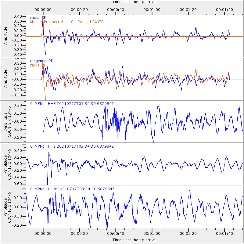
MPM Manuel Prospect Mine, California, USA - Earthquake Result Viewer
*The percent match for this event was below the threshold and hence no stack was calculated.
| Earthquake location: |
Fiji Islands Region |
| Earthquake latitude/longitude: |
-20.6/-178.4 |
| Earthquake time(UTC): |
2021/07/17 (198) 03:23:47 GMT |
| Earthquake Depth: |
559 km |
| Earthquake Magnitude: |
5.5 Mww |
| Earthquake Catalog/Contributor: |
NEIC PDE/us |
|
| Network: |
CI Caltech Regional Seismic Network |
| Station: |
MPM Manuel Prospect Mine, California, USA |
| Lat/Lon: |
36.06 N/117.49 W |
| Elevation: |
185 m |
|
| Distance: |
80.6 deg |
| Az: |
45.863 deg |
| Baz: |
236.06 deg |
| Ray Param: |
$rayparam |
*The percent match for this event was below the threshold and hence was not used in the summary stack. |
|
| Radial Match: |
59.370674 % |
| Radial Bump: |
400 |
| Transverse Match: |
59.77197 % |
| Transverse Bump: |
400 |
| SOD ConfigId: |
25131211 |
| Insert Time: |
2021-07-31 03:34:41.482 +0000 |
| GWidth: |
2.5 |
| Max Bumps: |
400 |
| Tol: |
0.001 |
|
Signal To Noise
| Channel | StoN | STA | LTA |
| CI:MPM: :HHZ:20210717T03:34:30.687984Z | 2.7060812 | 2.0919678E-7 | 7.7306176E-8 |
| CI:MPM: :HHN:20210717T03:34:30.687984Z | 0.90733755 | 5.8302827E-8 | 6.4257044E-8 |
| CI:MPM: :HHE:20210717T03:34:30.687984Z | 1.5077045 | 1.0687999E-7 | 7.0889214E-8 |
| Arrivals |
| Ps | |
| PpPs | |
| PsPs/PpSs | |


