You are here: Home > Network List > CN - Canadian National Seismograph Network Stations List
> Station INK INUVIK, NT > Earthquake Result Viewer
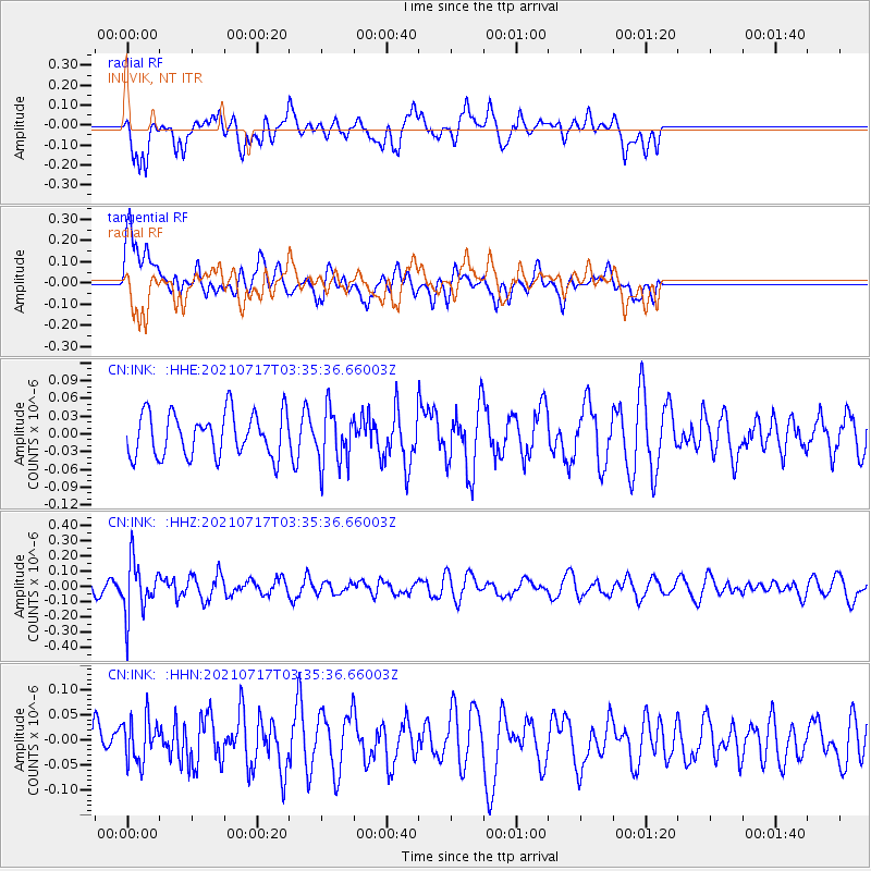
INK INUVIK, NT - Earthquake Result Viewer
*The percent match for this event was below the threshold and hence no stack was calculated.
| Earthquake location: |
Fiji Islands Region |
| Earthquake latitude/longitude: |
-20.6/-178.4 |
| Earthquake time(UTC): |
2021/07/17 (198) 03:23:47 GMT |
| Earthquake Depth: |
559 km |
| Earthquake Magnitude: |
5.5 Mww |
| Earthquake Catalog/Contributor: |
NEIC PDE/us |
|
| Network: |
CN Canadian National Seismograph Network |
| Station: |
INK INUVIK, NT |
| Lat/Lon: |
68.31 N/133.53 W |
| Elevation: |
44 m |
|
| Distance: |
94.5 deg |
| Az: |
15.25 deg |
| Baz: |
221.505 deg |
| Ray Param: |
$rayparam |
*The percent match for this event was below the threshold and hence was not used in the summary stack. |
|
| Radial Match: |
59.700974 % |
| Radial Bump: |
400 |
| Transverse Match: |
51.315735 % |
| Transverse Bump: |
400 |
| SOD ConfigId: |
25131211 |
| Insert Time: |
2021-07-31 03:35:36.626 +0000 |
| GWidth: |
2.5 |
| Max Bumps: |
400 |
| Tol: |
0.001 |
|
Signal To Noise
| Channel | StoN | STA | LTA |
| CN:INK: :HHZ:20210717T03:35:36.66003Z | 3.6613858 | 1.7064356E-7 | 4.6606278E-8 |
| CN:INK: :HHN:20210717T03:35:36.66003Z | 1.1757818 | 4.3384265E-8 | 3.689823E-8 |
| CN:INK: :HHE:20210717T03:35:36.66003Z | 1.2598585 | 4.6096176E-8 | 3.6588375E-8 |
| Arrivals |
| Ps | |
| PpPs | |
| PsPs/PpSs | |


