You are here: Home > Network List > GS - US Geological Survey Networks Stations List
> Station KAN10 Keim Farm > Earthquake Result Viewer
KAN10 Keim Farm - Earthquake Result Viewer
*The percent match for this event was below the threshold and hence no stack was calculated.
| Earthquake location: |
Northwest Of Kuril Islands |
| Earthquake latitude/longitude: |
52.6/153.0 |
| Earthquake time(UTC): |
2018/01/18 (018) 12:08:52 GMT |
| Earthquake Depth: |
448 km |
| Earthquake Magnitude: |
5.7 Mww |
| Earthquake Catalog/Contributor: |
NEIC PDE/us |
|
| Network: |
GS US Geological Survey Networks |
| Station: |
KAN10 Keim Farm |
| Lat/Lon: |
37.12 N/98.10 W |
| Elevation: |
417 m |
|
| Distance: |
71.5 deg |
| Az: |
52.883 deg |
| Baz: |
322.484 deg |
| Ray Param: |
$rayparam |
*The percent match for this event was below the threshold and hence was not used in the summary stack. |
|
| Radial Match: |
46.132248 % |
| Radial Bump: |
400 |
| Transverse Match: |
53.61174 % |
| Transverse Bump: |
400 |
| SOD ConfigId: |
2546091 |
| Insert Time: |
2018-02-01 12:10:11.392 +0000 |
| GWidth: |
2.5 |
| Max Bumps: |
400 |
| Tol: |
0.001 |
|
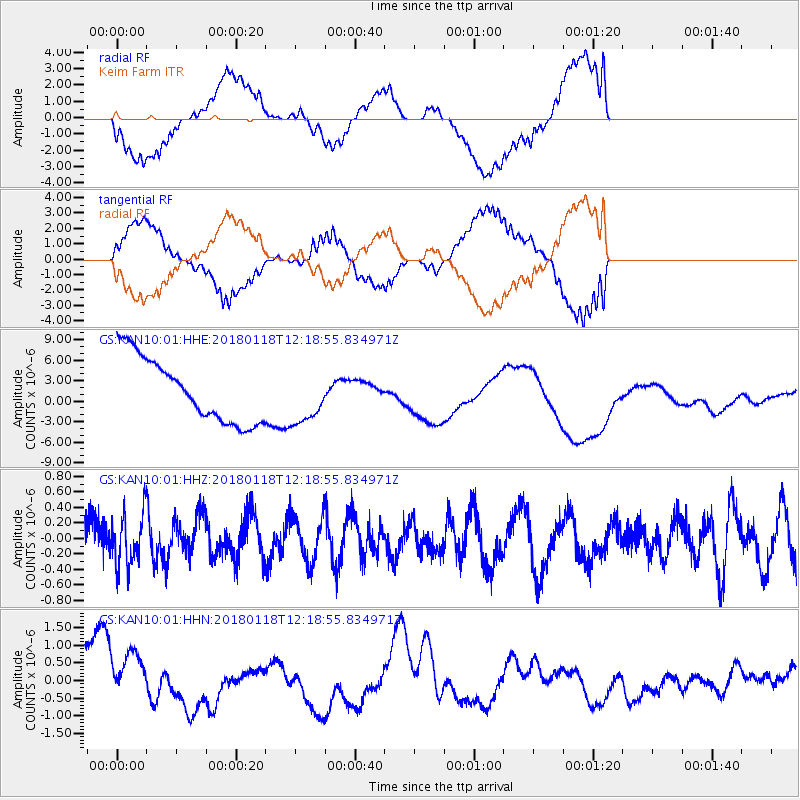
Signal To Noise
| Channel | StoN | STA | LTA |
| GS:KAN10:01:HHZ:20180118T12:18:55.834971Z | 1.5548537 | 3.3038677E-7 | 2.1248736E-7 |
| GS:KAN10:01:HHN:20180118T12:18:55.834971Z | 1.118569 | 1.0273387E-6 | 9.184402E-7 |
| GS:KAN10:01:HHE:20180118T12:18:55.834971Z | 0.83844674 | 3.9543193E-6 | 4.7162434E-6 |
| Arrivals |
| Ps | |
| PpPs | |
| PsPs/PpSs | |


