
POGR XW.POGR - Earthquake Result Viewer
| ||||||||||||||||||
| ||||||||||||||||||
| ||||||||||||||||||
|
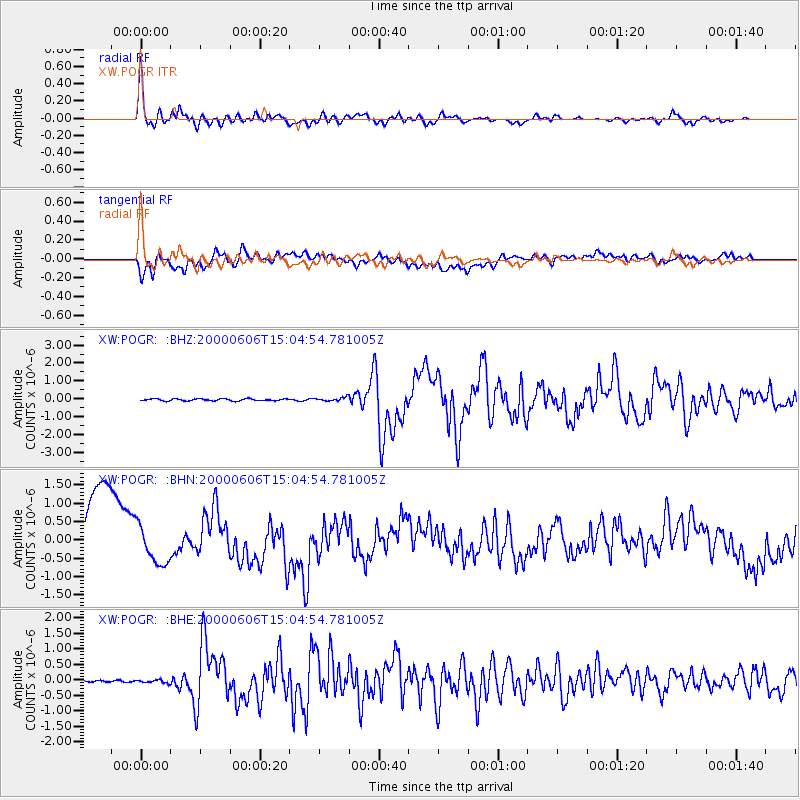
Signal To Noise
| Channel | StoN | STA | LTA |
| XW:POGR: :BHN:20000606T15:04:54.781005Z | 0.65060836 | 4.9525005E-7 | 7.6121074E-7 |
| XW:POGR: :BHE:20000606T15:04:54.781005Z | 1.2312268 | 5.1718136E-8 | 4.200537E-8 |
| XW:POGR: :BHZ:20000606T15:04:54.781005Z | 1.8026584 | 1.0350072E-7 | 5.74156E-8 |
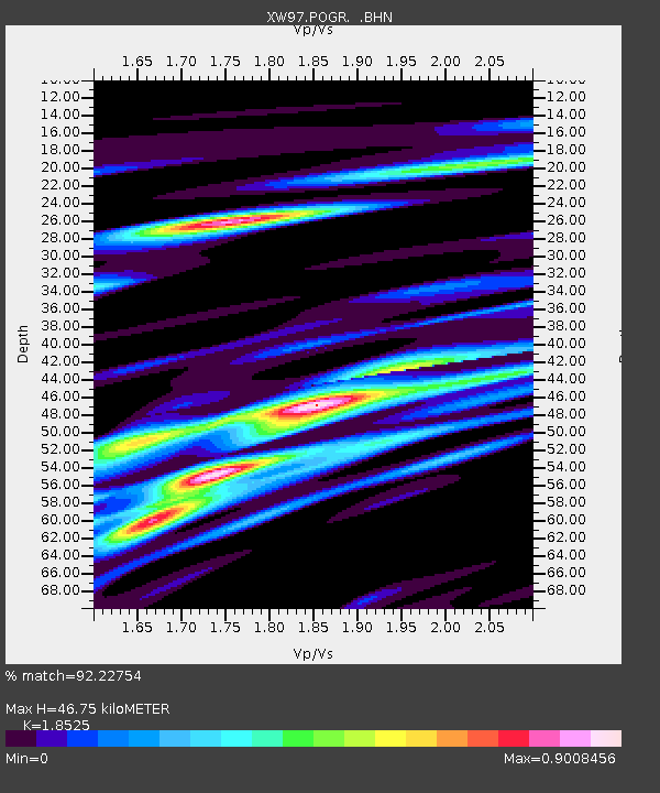
| Arrivals | |
| Ps | 6.5 SECOND |
| PpPs | 19 SECOND |
| PsPs/PpSs | 26 SECOND |

