You are here: Home > Network List > TA - USArray Transportable Network (new EarthScope stations) Stations List
> Station TUL3 Leonard, OK, USA > Earthquake Result Viewer
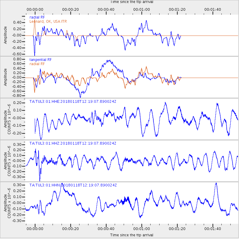
TUL3 Leonard, OK, USA - Earthquake Result Viewer
*The percent match for this event was below the threshold and hence no stack was calculated.
| Earthquake location: |
Northwest Of Kuril Islands |
| Earthquake latitude/longitude: |
52.6/153.0 |
| Earthquake time(UTC): |
2018/01/18 (018) 12:08:52 GMT |
| Earthquake Depth: |
448 km |
| Earthquake Magnitude: |
5.7 Mww |
| Earthquake Catalog/Contributor: |
NEIC PDE/us |
|
| Network: |
TA USArray Transportable Network (new EarthScope stations) |
| Station: |
TUL3 Leonard, OK, USA |
| Lat/Lon: |
35.91 N/95.79 W |
| Elevation: |
265 m |
|
| Distance: |
73.6 deg |
| Az: |
52.091 deg |
| Baz: |
323.611 deg |
| Ray Param: |
$rayparam |
*The percent match for this event was below the threshold and hence was not used in the summary stack. |
|
| Radial Match: |
56.827435 % |
| Radial Bump: |
400 |
| Transverse Match: |
51.90454 % |
| Transverse Bump: |
400 |
| SOD ConfigId: |
2546091 |
| Insert Time: |
2018-02-01 12:11:49.875 +0000 |
| GWidth: |
2.5 |
| Max Bumps: |
400 |
| Tol: |
0.001 |
|
Signal To Noise
| Channel | StoN | STA | LTA |
| TA:TUL3:01:HHZ:20180118T12:19:07.890024Z | 2.3966308 | 1.4269031E-7 | 5.953788E-8 |
| TA:TUL3:01:HHN:20180118T12:19:07.890024Z | 0.8909306 | 6.618475E-8 | 7.4287215E-8 |
| TA:TUL3:01:HHE:20180118T12:19:07.890024Z | 0.9137451 | 7.366572E-8 | 8.061955E-8 |
| Arrivals |
| Ps | |
| PpPs | |
| PsPs/PpSs | |


