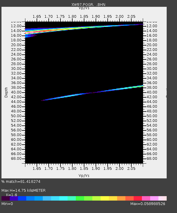
POGR XW.POGR - Earthquake Result Viewer
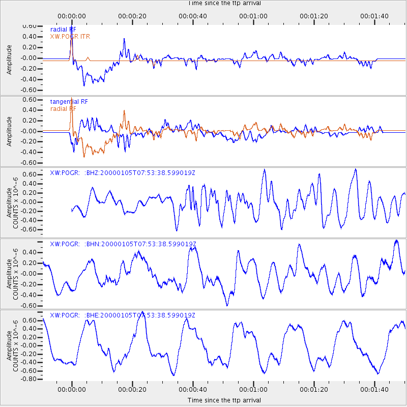
Earthquake location: Santa Cruz Islands
Earthquake latitude/longitude: -11.4/165.4
Earthquake time(UTC): 2000/01/05 (005) 07:40:40 GMT
Earthquake Depth: 33 km
Earthquake Magnitude: 5.7 MB, 6.0 MS, 6.2 MW, 6.1 MW
Earthquake Catalog/Contributor: WHDF/NEIC
Network: XW Tien Shan Continental Dynamics
Station: POGR XW.POGR
Lat/Lon: 41.02 N/75.55 E
Elevation: 2357 m
Distance: 97.2 deg
Az: 310.294 deg
Baz: 98.706 deg
Ray Param: 0.04026097
Estimated Moho Depth: 14.75 km
Estimated Crust Vp/Vs: 1.60
Assumed Crust Vp: 6.491 km/s
Estimated Crust Vs: 4.057 km/s
Estimated Crust Poisson's Ratio: 0.18
Radial Match: 81.418274 %
Radial Bump: 400
Transverse Match: 77.12807 %
Transverse Bump: 400
SOD ConfigId: 3744
Insert Time: 2010-02-26 15:46:04.739 +0000
GWidth: 2.5
Max Bumps: 400
Tol: 0.001

Signal To Noise

ChannelStoNSTALTA
XW:POGR: :BHN:20000105T07:53:38.599019Z1.10410372.2800506E-72.0650693E-7
XW:POGR: :BHE:20000105T07:53:38.599019Z0.99193093.883837E-73.915431E-7
XW:POGR: :BHZ:20000105T07:53:38.599019Z1.45316922.2268108E-71.5323823E-7
Arrivals
Ps1.4 SECOND
PpPs5.8 SECOND
PsPs/PpSs7.2 SECOND