You are here: Home > Network List > TX - Texas Seismological Network Stations List
> Station WTFS Witchita Falls > Earthquake Result Viewer
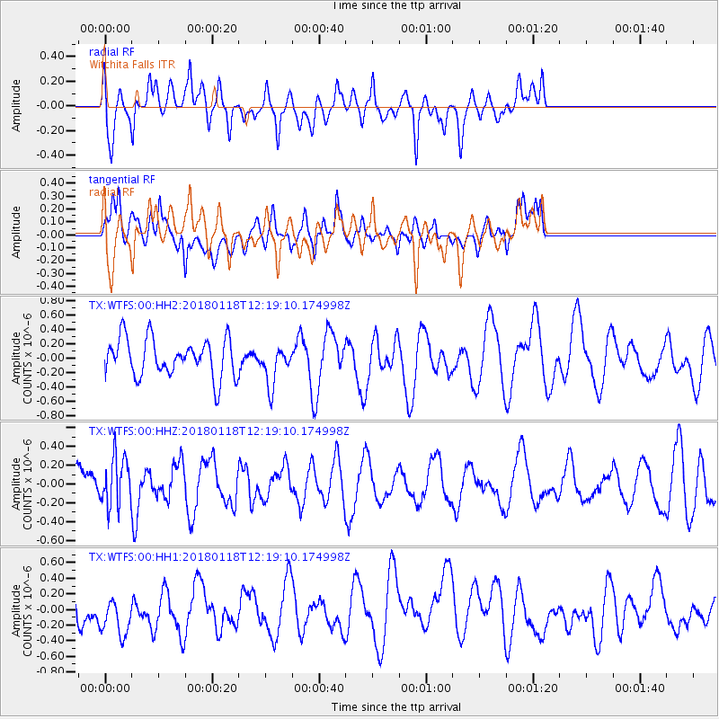
WTFS Witchita Falls - Earthquake Result Viewer
*The percent match for this event was below the threshold and hence no stack was calculated.
| Earthquake location: |
Northwest Of Kuril Islands |
| Earthquake latitude/longitude: |
52.6/153.0 |
| Earthquake time(UTC): |
2018/01/18 (018) 12:08:52 GMT |
| Earthquake Depth: |
448 km |
| Earthquake Magnitude: |
5.7 Mww |
| Earthquake Catalog/Contributor: |
NEIC PDE/us |
|
| Network: |
TX Texas Seismological Network |
| Station: |
WTFS Witchita Falls |
| Lat/Lon: |
33.77 N/98.46 W |
| Elevation: |
277 m |
|
| Distance: |
74.0 deg |
| Az: |
55.259 deg |
| Baz: |
322.977 deg |
| Ray Param: |
$rayparam |
*The percent match for this event was below the threshold and hence was not used in the summary stack. |
|
| Radial Match: |
43.293003 % |
| Radial Bump: |
400 |
| Transverse Match: |
42.912937 % |
| Transverse Bump: |
400 |
| SOD ConfigId: |
2546091 |
| Insert Time: |
2018-02-01 12:12:08.784 +0000 |
| GWidth: |
2.5 |
| Max Bumps: |
400 |
| Tol: |
0.001 |
|
Signal To Noise
| Channel | StoN | STA | LTA |
| TX:WTFS:00:HHZ:20180118T12:19:10.174998Z | 0.7960777 | 2.6100946E-7 | 3.2786932E-7 |
| TX:WTFS:00:HH1:20180118T12:19:10.174998Z | 0.9345382 | 2.7325473E-7 | 2.9239547E-7 |
| TX:WTFS:00:HH2:20180118T12:19:10.174998Z | 1.0541251 | 2.7791458E-7 | 2.6364478E-7 |
| Arrivals |
| Ps | |
| PpPs | |
| PsPs/PpSs | |


