You are here: Home > Network List > US - United States National Seismic Network Stations List
> Station HAWA Hanford, Washington, USA > Earthquake Result Viewer
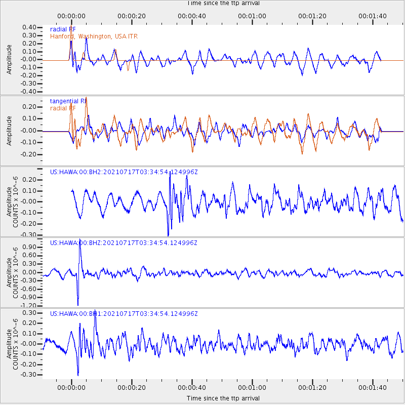
HAWA Hanford, Washington, USA - Earthquake Result Viewer
*The percent match for this event was below the threshold and hence no stack was calculated.
| Earthquake location: |
Fiji Islands Region |
| Earthquake latitude/longitude: |
-20.6/-178.4 |
| Earthquake time(UTC): |
2021/07/17 (198) 03:23:47 GMT |
| Earthquake Depth: |
559 km |
| Earthquake Magnitude: |
5.5 Mww |
| Earthquake Catalog/Contributor: |
NEIC PDE/us |
|
| Network: |
US United States National Seismic Network |
| Station: |
HAWA Hanford, Washington, USA |
| Lat/Lon: |
46.39 N/119.53 W |
| Elevation: |
364 m |
|
| Distance: |
85.3 deg |
| Az: |
36.467 deg |
| Baz: |
233.549 deg |
| Ray Param: |
$rayparam |
*The percent match for this event was below the threshold and hence was not used in the summary stack. |
|
| Radial Match: |
69.51757 % |
| Radial Bump: |
400 |
| Transverse Match: |
67.5102 % |
| Transverse Bump: |
400 |
| SOD ConfigId: |
25131211 |
| Insert Time: |
2021-07-31 03:44:49.352 +0000 |
| GWidth: |
2.5 |
| Max Bumps: |
400 |
| Tol: |
0.001 |
|
Signal To Noise
| Channel | StoN | STA | LTA |
| US:HAWA:00:BHZ:20210717T03:34:54.124996Z | 5.83268 | 4.51849E-7 | 7.74685E-8 |
| US:HAWA:00:BH1:20210717T03:34:54.124996Z | 3.0426981 | 1.1619131E-7 | 3.8186933E-8 |
| US:HAWA:00:BH2:20210717T03:34:54.124996Z | 1.938227 | 1.3109107E-7 | 6.7634524E-8 |
| Arrivals |
| Ps | |
| PpPs | |
| PsPs/PpSs | |


