You are here: Home > Network List > US - United States National Seismic Network Stations List
> Station NEW Newport, Washington, USA > Earthquake Result Viewer
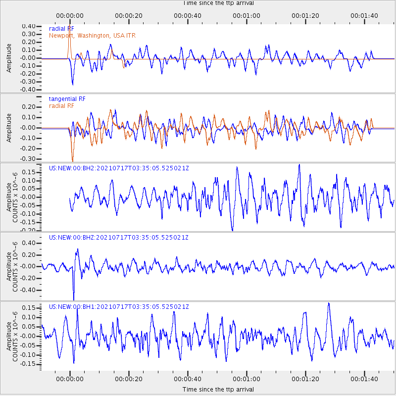
NEW Newport, Washington, USA - Earthquake Result Viewer
*The percent match for this event was below the threshold and hence no stack was calculated.
| Earthquake location: |
Fiji Islands Region |
| Earthquake latitude/longitude: |
-20.6/-178.4 |
| Earthquake time(UTC): |
2021/07/17 (198) 03:23:47 GMT |
| Earthquake Depth: |
559 km |
| Earthquake Magnitude: |
5.5 Mww |
| Earthquake Catalog/Contributor: |
NEIC PDE/us |
|
| Network: |
US United States National Seismic Network |
| Station: |
NEW Newport, Washington, USA |
| Lat/Lon: |
48.26 N/117.12 W |
| Elevation: |
760 m |
|
| Distance: |
87.7 deg |
| Az: |
35.899 deg |
| Baz: |
235.283 deg |
| Ray Param: |
$rayparam |
*The percent match for this event was below the threshold and hence was not used in the summary stack. |
|
| Radial Match: |
42.20352 % |
| Radial Bump: |
400 |
| Transverse Match: |
58.687492 % |
| Transverse Bump: |
400 |
| SOD ConfigId: |
25131211 |
| Insert Time: |
2021-07-31 03:44:59.462 +0000 |
| GWidth: |
2.5 |
| Max Bumps: |
400 |
| Tol: |
0.001 |
|
Signal To Noise
| Channel | StoN | STA | LTA |
| US:NEW:00:BHZ:20210717T03:35:05.525021Z | 3.2619727 | 1.8303504E-7 | 5.6111762E-8 |
| US:NEW:00:BH1:20210717T03:35:05.525021Z | 1.4682026 | 6.121969E-8 | 4.1697028E-8 |
| US:NEW:00:BH2:20210717T03:35:05.525021Z | 0.9294933 | 4.0990674E-8 | 4.410002E-8 |
| Arrivals |
| Ps | |
| PpPs | |
| PsPs/PpSs | |


