You are here: Home > Network List > US - United States National Seismic Network Stations List
> Station WUAZ Wupatki, Arizona, USA > Earthquake Result Viewer
WUAZ Wupatki, Arizona, USA - Earthquake Result Viewer
*The percent match for this event was below the threshold and hence no stack was calculated.
| Earthquake location: |
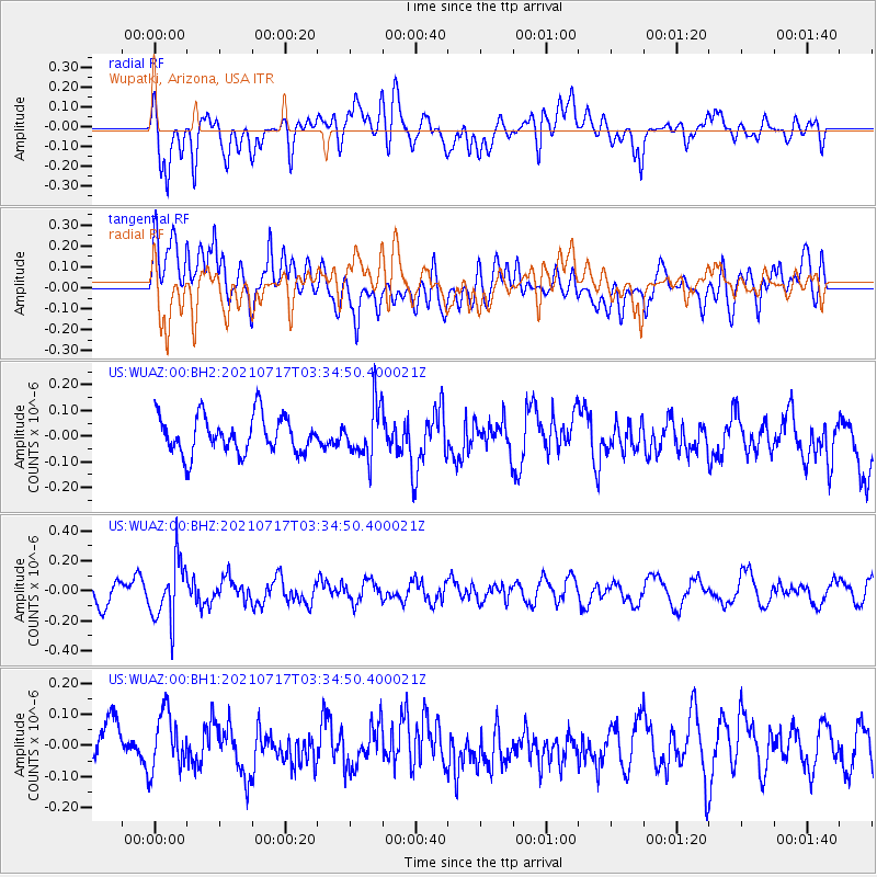
Fiji Islands Region |
| Earthquake latitude/longitude: |
-20.6/-178.4 |
| Earthquake time(UTC): |
2021/07/17 (198) 03:23:47 GMT |
| Earthquake Depth: |
559 km |
| Earthquake Magnitude: |
5.5 Mww |
| Earthquake Catalog/Contributor: |
NEIC PDE/us |
|
| Network: |
US United States National Seismic Network |
| Station: |
WUAZ Wupatki, Arizona, USA |
| Lat/Lon: |
35.52 N/111.37 W |
| Elevation: |
1592 m |
|
| Distance: |
84.5 deg |
| Az: |
48.977 deg |
| Baz: |
240.028 deg |
| Ray Param: |
$rayparam |
*The percent match for this event was below the threshold and hence was not used in the summary stack. |
|
| Radial Match: |
63.870342 % |
| Radial Bump: |
400 |
| Transverse Match: |
64.59762 % |
| Transverse Bump: |
400 |
| SOD ConfigId: |
25131211 |
| Insert Time: |
2021-07-31 03:45:06.089 +0000 |
| GWidth: |
2.5 |
| Max Bumps: |
400 |
| Tol: |
0.001 |
|
Signal To Noise
| Channel | StoN | STA | LTA |
| US:WUAZ:00:BHZ:20210717T03:34:50.400021Z | 2.5107415 | 1.998311E-7 | 7.959047E-8 |
| US:WUAZ:00:BH1:20210717T03:34:50.400021Z | 1.6141382 | 9.66587E-8 | 5.9882545E-8 |
| US:WUAZ:00:BH2:20210717T03:34:50.400021Z | 1.4097193 | 1.03121245E-7 | 7.315019E-8 |
| Arrivals |
| Ps | |
| PpPs | |
| PsPs/PpSs | |


