You are here: Home > Network List > UW - Pacific Northwest Regional Seismic Network Stations List
> Station IRON Crane, OR, USA > Earthquake Result Viewer
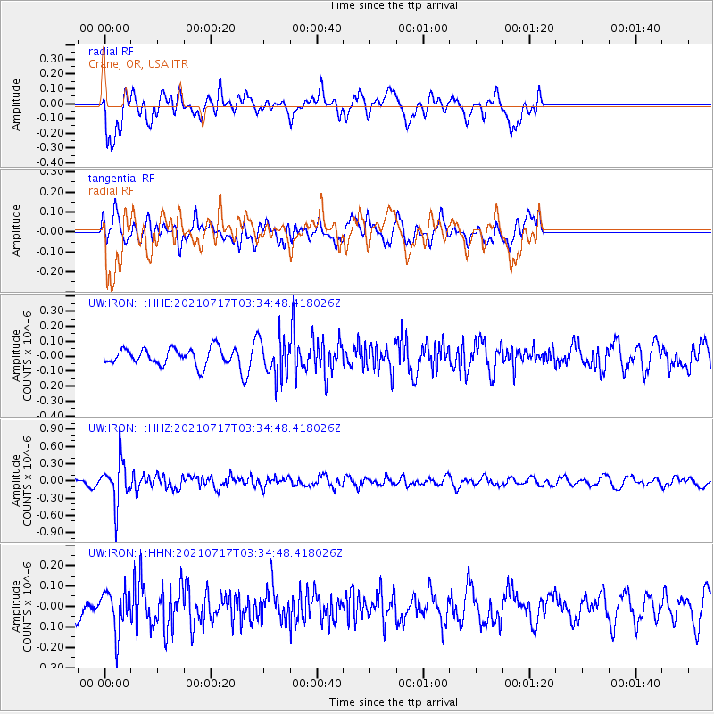
IRON Crane, OR, USA - Earthquake Result Viewer
*The percent match for this event was below the threshold and hence no stack was calculated.
| Earthquake location: |
Fiji Islands Region |
| Earthquake latitude/longitude: |
-20.6/-178.4 |
| Earthquake time(UTC): |
2021/07/17 (198) 03:23:47 GMT |
| Earthquake Depth: |
559 km |
| Earthquake Magnitude: |
5.5 Mww |
| Earthquake Catalog/Contributor: |
NEIC PDE/us |
|
| Network: |
UW Pacific Northwest Regional Seismic Network |
| Station: |
IRON Crane, OR, USA |
| Lat/Lon: |
43.36 N/118.47 W |
| Elevation: |
1226 m |
|
| Distance: |
84.1 deg |
| Az: |
39.378 deg |
| Baz: |
234.564 deg |
| Ray Param: |
$rayparam |
*The percent match for this event was below the threshold and hence was not used in the summary stack. |
|
| Radial Match: |
61.350346 % |
| Radial Bump: |
400 |
| Transverse Match: |
54.37461 % |
| Transverse Bump: |
400 |
| SOD ConfigId: |
25131211 |
| Insert Time: |
2021-07-31 03:46:31.042 +0000 |
| GWidth: |
2.5 |
| Max Bumps: |
400 |
| Tol: |
0.001 |
|
Signal To Noise
| Channel | StoN | STA | LTA |
| UW:IRON: :HHZ:20210717T03:34:48.418026Z | 5.135242 | 3.6842232E-7 | 7.1743905E-8 |
| UW:IRON: :HHN:20210717T03:34:48.418026Z | 1.6243113 | 9.9410784E-8 | 6.12018E-8 |
| UW:IRON: :HHE:20210717T03:34:48.418026Z | 2.3385751 | 1.2752042E-7 | 5.452911E-8 |
| Arrivals |
| Ps | |
| PpPs | |
| PsPs/PpSs | |


