You are here: Home > Network List > WY - Yellowstone Wyoming Seismic Network Stations List
> Station YHH Holmes Hill, YNP, WY, USA > Earthquake Result Viewer
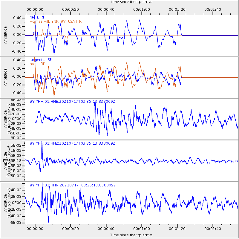
YHH Holmes Hill, YNP, WY, USA - Earthquake Result Viewer
*The percent match for this event was below the threshold and hence no stack was calculated.
| Earthquake location: |
Fiji Islands Region |
| Earthquake latitude/longitude: |
-20.6/-178.4 |
| Earthquake time(UTC): |
2021/07/17 (198) 03:23:47 GMT |
| Earthquake Depth: |
559 km |
| Earthquake Magnitude: |
5.5 Mww |
| Earthquake Catalog/Contributor: |
NEIC PDE/us |
|
| Network: |
WY Yellowstone Wyoming Seismic Network |
| Station: |
YHH Holmes Hill, YNP, WY, USA |
| Lat/Lon: |
44.79 N/110.85 W |
| Elevation: |
2717 m |
|
| Distance: |
89.5 deg |
| Az: |
41.151 deg |
| Baz: |
239.952 deg |
| Ray Param: |
$rayparam |
*The percent match for this event was below the threshold and hence was not used in the summary stack. |
|
| Radial Match: |
66.67488 % |
| Radial Bump: |
400 |
| Transverse Match: |
66.45957 % |
| Transverse Bump: |
400 |
| SOD ConfigId: |
25131211 |
| Insert Time: |
2021-07-31 03:47:58.289 +0000 |
| GWidth: |
2.5 |
| Max Bumps: |
400 |
| Tol: |
0.001 |
|
Signal To Noise
| Channel | StoN | STA | LTA |
| WY:YHH:01:HHZ:20210717T03:35:13.838009Z | 4.6382966 | 6.201594E-9 | 1.3370413E-9 |
| WY:YHH:01:HHN:20210717T03:35:13.838009Z | 1.6227225 | 1.7958642E-9 | 1.1066983E-9 |
| WY:YHH:01:HHE:20210717T03:35:13.838009Z | 3.0591555 | 3.2237624E-9 | 1.0538079E-9 |
| Arrivals |
| Ps | |
| PpPs | |
| PsPs/PpSs | |


