You are here: Home > Network List > AZ - ANZA Regional Network Stations List
> Station SMER AZ.SMER > Earthquake Result Viewer
SMER AZ.SMER - Earthquake Result Viewer
*The percent match for this event was below the threshold and hence no stack was calculated.
| Earthquake location: |
Northern Mid-Atlantic Ridge |
| Earthquake latitude/longitude: |
28.4/-43.7 |
| Earthquake time(UTC): |
2021/07/17 (198) 21:31:18 GMT |
| Earthquake Depth: |
10 km |
| Earthquake Magnitude: |
5.5 Mww |
| Earthquake Catalog/Contributor: |
NEIC PDE/us |
|
| Network: |
AZ ANZA Regional Network |
| Station: |
SMER AZ.SMER |
| Lat/Lon: |
33.46 N/117.17 W |
| Elevation: |
355 m |
|
| Distance: |
62.0 deg |
| Az: |
294.819 deg |
| Baz: |
72.966 deg |
| Ray Param: |
$rayparam |
*The percent match for this event was below the threshold and hence was not used in the summary stack. |
|
| Radial Match: |
57.26968 % |
| Radial Bump: |
400 |
| Transverse Match: |
51.571365 % |
| Transverse Bump: |
400 |
| SOD ConfigId: |
25131211 |
| Insert Time: |
2021-07-31 21:37:48.707 +0000 |
| GWidth: |
2.5 |
| Max Bumps: |
400 |
| Tol: |
0.001 |
|
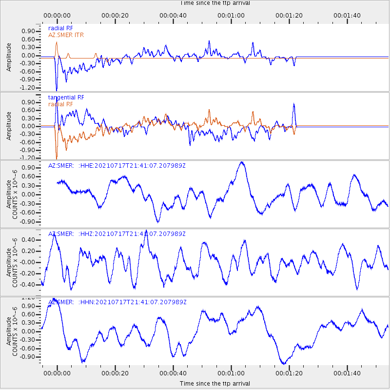
Signal To Noise
| Channel | StoN | STA | LTA |
| AZ:SMER: :HHZ:20210717T21:41:07.207989Z | 1.0226443 | 3.0639592E-7 | 2.996114E-7 |
| AZ:SMER: :HHN:20210717T21:41:07.207989Z | 3.7036726 | 6.9797926E-7 | 1.8845599E-7 |
| AZ:SMER: :HHE:20210717T21:41:07.207989Z | 1.9269354 | 5.345305E-7 | 2.7739927E-7 |
| Arrivals |
| Ps | |
| PpPs | |
| PsPs/PpSs | |


