You are here: Home > Network List > US - United States National Seismic Network Stations List
> Station AMTX Amarillo, Texas, USA > Earthquake Result Viewer
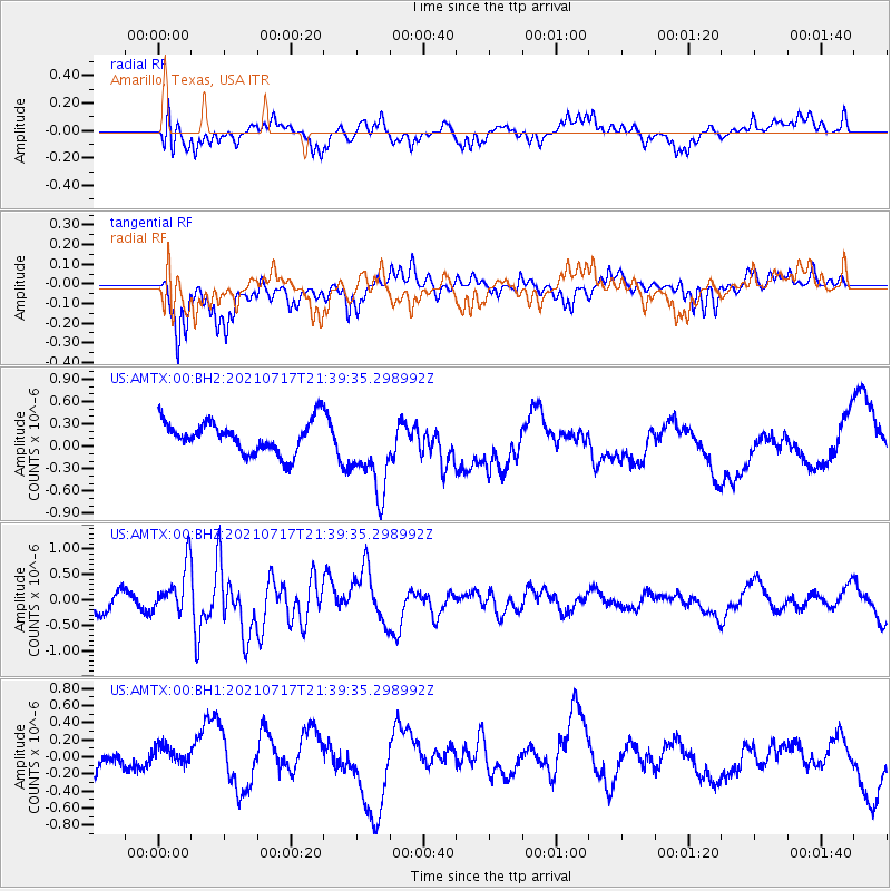
AMTX Amarillo, Texas, USA - Earthquake Result Viewer
*The percent match for this event was below the threshold and hence no stack was calculated.
| Earthquake location: |
Northern Mid-Atlantic Ridge |
| Earthquake latitude/longitude: |
28.4/-43.7 |
| Earthquake time(UTC): |
2021/07/17 (198) 21:31:18 GMT |
| Earthquake Depth: |
10 km |
| Earthquake Magnitude: |
5.5 Mww |
| Earthquake Catalog/Contributor: |
NEIC PDE/us |
|
| Network: |
US United States National Seismic Network |
| Station: |
AMTX Amarillo, Texas, USA |
| Lat/Lon: |
34.53 N/101.41 W |
| Elevation: |
1010 m |
|
| Distance: |
49.0 deg |
| Az: |
292.424 deg |
| Baz: |
80.412 deg |
| Ray Param: |
$rayparam |
*The percent match for this event was below the threshold and hence was not used in the summary stack. |
|
| Radial Match: |
49.690372 % |
| Radial Bump: |
400 |
| Transverse Match: |
70.870865 % |
| Transverse Bump: |
400 |
| SOD ConfigId: |
25131211 |
| Insert Time: |
2021-07-31 21:52:37.584 +0000 |
| GWidth: |
2.5 |
| Max Bumps: |
400 |
| Tol: |
0.001 |
|
Signal To Noise
| Channel | StoN | STA | LTA |
| US:AMTX:00:BHZ:20210717T21:39:35.298992Z | 1.1738327 | 4.6426234E-7 | 3.955098E-7 |
| US:AMTX:00:BH1:20210717T21:39:35.298992Z | 0.62365705 | 1.9256308E-7 | 3.0876436E-7 |
| US:AMTX:00:BH2:20210717T21:39:35.298992Z | 2.5238972 | 4.8140663E-7 | 1.907394E-7 |
| Arrivals |
| Ps | |
| PpPs | |
| PsPs/PpSs | |


