You are here: Home > Network List > UU - University of Utah Regional Network Stations List
> Station CCUT Cedar City, UT, USA > Earthquake Result Viewer
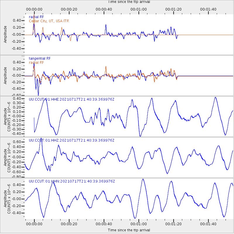
CCUT Cedar City, UT, USA - Earthquake Result Viewer
*The percent match for this event was below the threshold and hence no stack was calculated.
| Earthquake location: |
Northern Mid-Atlantic Ridge |
| Earthquake latitude/longitude: |
28.4/-43.7 |
| Earthquake time(UTC): |
2021/07/17 (198) 21:31:18 GMT |
| Earthquake Depth: |
10 km |
| Earthquake Magnitude: |
5.5 Mww |
| Earthquake Catalog/Contributor: |
NEIC PDE/us |
|
| Network: |
UU University of Utah Regional Network |
| Station: |
CCUT Cedar City, UT, USA |
| Lat/Lon: |
37.55 N/113.36 W |
| Elevation: |
2127 m |
|
| Distance: |
58.0 deg |
| Az: |
298.441 deg |
| Baz: |
76.983 deg |
| Ray Param: |
$rayparam |
*The percent match for this event was below the threshold and hence was not used in the summary stack. |
|
| Radial Match: |
65.02655 % |
| Radial Bump: |
400 |
| Transverse Match: |
86.19967 % |
| Transverse Bump: |
346 |
| SOD ConfigId: |
25131211 |
| Insert Time: |
2021-07-31 21:53:03.837 +0000 |
| GWidth: |
2.5 |
| Max Bumps: |
400 |
| Tol: |
0.001 |
|
Signal To Noise
| Channel | StoN | STA | LTA |
| UU:CCUT:01:HHZ:20210717T21:40:39.369976Z | 1.595324 | 3.4417917E-7 | 2.1574247E-7 |
| UU:CCUT:01:HHN:20210717T21:40:39.369976Z | 1.3615493 | 2.6543862E-7 | 1.9495337E-7 |
| UU:CCUT:01:HHE:20210717T21:40:39.369976Z | 0.49403128 | 1.0805737E-7 | 2.1872577E-7 |
| Arrivals |
| Ps | |
| PpPs | |
| PsPs/PpSs | |


