You are here: Home > Network List > CN - Canadian National Seismograph Network Stations List
> Station INK INUVIK, NT > Earthquake Result Viewer
INK INUVIK, NT - Earthquake Result Viewer
*The percent match for this event was below the threshold and hence no stack was calculated.
| Earthquake location: |
Southern Iran |
| Earthquake latitude/longitude: |
29.7/51.1 |
| Earthquake time(UTC): |
2021/07/18 (199) 14:34:19 GMT |
| Earthquake Depth: |
10 km |
| Earthquake Magnitude: |
5.4 Mww |
| Earthquake Catalog/Contributor: |
NEIC PDE/us |
|
| Network: |
CN Canadian National Seismograph Network |
| Station: |
INK INUVIK, NT |
| Lat/Lon: |
68.31 N/133.53 W |
| Elevation: |
44 m |
|
| Distance: |
82.2 deg |
| Az: |
1.745 deg |
| Baz: |
355.913 deg |
| Ray Param: |
$rayparam |
*The percent match for this event was below the threshold and hence was not used in the summary stack. |
|
| Radial Match: |
78.48808 % |
| Radial Bump: |
387 |
| Transverse Match: |
77.79394 % |
| Transverse Bump: |
400 |
| SOD ConfigId: |
25131211 |
| Insert Time: |
2021-08-01 14:42:14.742 +0000 |
| GWidth: |
2.5 |
| Max Bumps: |
400 |
| Tol: |
0.001 |
|
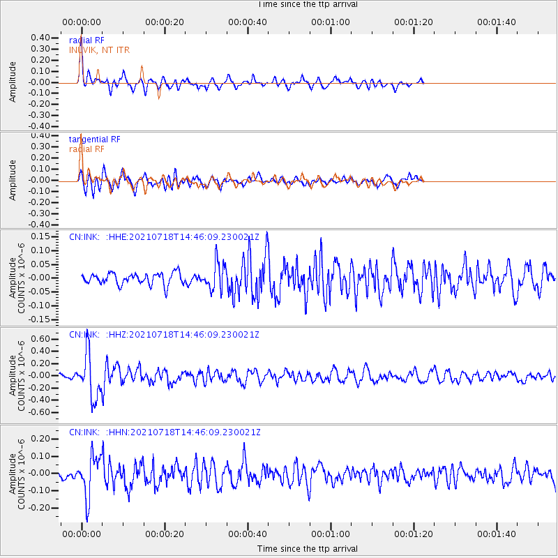
Signal To Noise
| Channel | StoN | STA | LTA |
| CN:INK: :HHZ:20210718T14:46:09.230021Z | 6.0619264 | 3.6726098E-7 | 6.058486E-8 |
| CN:INK: :HHN:20210718T14:46:09.230021Z | 3.5327718 | 1.2038906E-7 | 3.4077793E-8 |
| CN:INK: :HHE:20210718T14:46:09.230021Z | 2.4211357 | 4.988652E-8 | 2.0604595E-8 |
| Arrivals |
| Ps | |
| PpPs | |
| PsPs/PpSs | |


