You are here: Home > Network List > AV - Alaska Volcano Observatory Stations List
> Station PLBL Mt. Peulik Volcano, Alaska > Earthquake Result Viewer
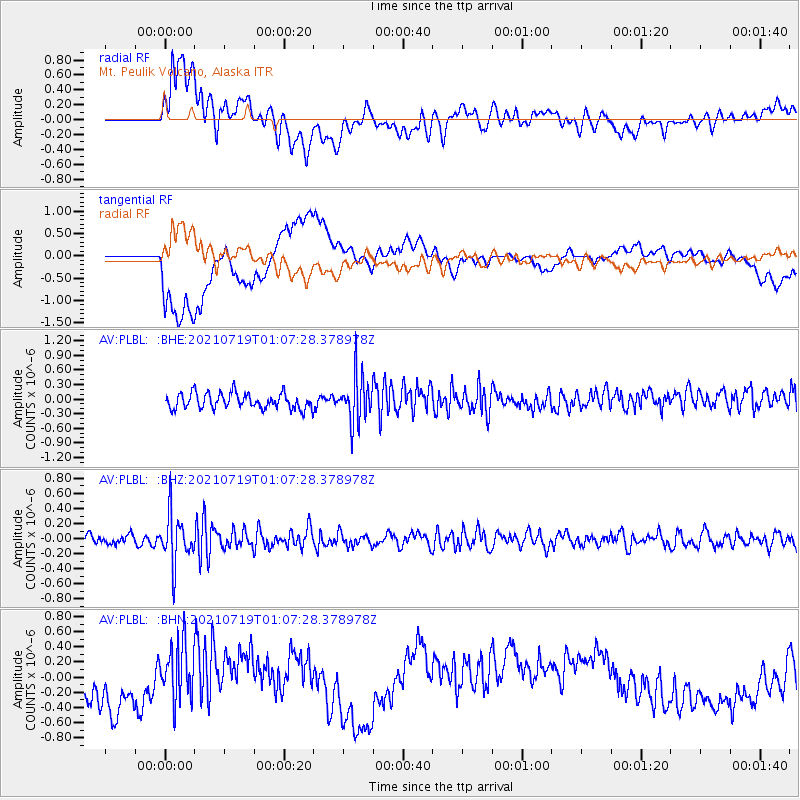
PLBL Mt. Peulik Volcano, Alaska - Earthquake Result Viewer
*The percent match for this event was below the threshold and hence no stack was calculated.
| Earthquake location: |
Minahassa Peninsula, Sulawesi |
| Earthquake latitude/longitude: |
-0.0/123.2 |
| Earthquake time(UTC): |
2021/07/19 (200) 00:55:43 GMT |
| Earthquake Depth: |
159 km |
| Earthquake Magnitude: |
5.2 Mww |
| Earthquake Catalog/Contributor: |
NEIC PDE/us |
|
| Network: |
AV Alaska Volcano Observatory |
| Station: |
PLBL Mt. Peulik Volcano, Alaska |
| Lat/Lon: |
57.70 N/156.82 W |
| Elevation: |
461 m |
|
| Distance: |
84.6 deg |
| Az: |
32.074 deg |
| Baz: |
261.489 deg |
| Ray Param: |
$rayparam |
*The percent match for this event was below the threshold and hence was not used in the summary stack. |
|
| Radial Match: |
53.19603 % |
| Radial Bump: |
400 |
| Transverse Match: |
43.66617 % |
| Transverse Bump: |
400 |
| SOD ConfigId: |
25131211 |
| Insert Time: |
2021-08-02 01:00:29.876 +0000 |
| GWidth: |
2.5 |
| Max Bumps: |
400 |
| Tol: |
0.001 |
|
Signal To Noise
| Channel | StoN | STA | LTA |
| AV:PLBL: :BHZ:20210719T01:07:28.378978Z | 4.598097 | 3.2134935E-7 | 6.988747E-8 |
| AV:PLBL: :BHN:20210719T01:07:28.378978Z | 1.3782713 | 3.8471052E-7 | 2.7912537E-7 |
| AV:PLBL: :BHE:20210719T01:07:28.378978Z | 3.0555358 | 4.8480734E-7 | 1.5866524E-7 |
| Arrivals |
| Ps | |
| PpPs | |
| PsPs/PpSs | |


