You are here: Home > Network List > US - United States National Seismic Network Stations List
> Station DGMT Dagmar, Montana, USA > Earthquake Result Viewer
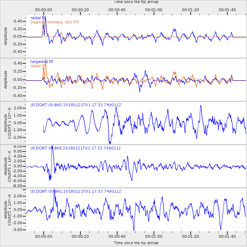
DGMT Dagmar, Montana, USA - Earthquake Result Viewer
*The percent match for this event was below the threshold and hence no stack was calculated.
| Earthquake location: |
Northern Chile |
| Earthquake latitude/longitude: |
-18.9/-69.6 |
| Earthquake time(UTC): |
2018/01/21 (021) 01:06:42 GMT |
| Earthquake Depth: |
111 km |
| Earthquake Magnitude: |
6.3 Mww |
| Earthquake Catalog/Contributor: |
NEIC PDE/us |
|
| Network: |
US United States National Seismic Network |
| Station: |
DGMT Dagmar, Montana, USA |
| Lat/Lon: |
48.47 N/104.20 W |
| Elevation: |
0.0 m |
|
| Distance: |
73.8 deg |
| Az: |
336.842 deg |
| Baz: |
145.978 deg |
| Ray Param: |
$rayparam |
*The percent match for this event was below the threshold and hence was not used in the summary stack. |
|
| Radial Match: |
73.369446 % |
| Radial Bump: |
400 |
| Transverse Match: |
60.34278 % |
| Transverse Bump: |
400 |
| SOD ConfigId: |
2546091 |
| Insert Time: |
2018-02-04 01:12:43.607 +0000 |
| GWidth: |
2.5 |
| Max Bumps: |
400 |
| Tol: |
0.001 |
|
Signal To Noise
| Channel | StoN | STA | LTA |
| US:DGMT:00:BHZ:20180121T01:17:33.749011Z | 14.950055 | 3.2703128E-6 | 2.1874921E-7 |
| US:DGMT:00:BH1:20180121T01:17:33.749011Z | 1.4155537 | 7.303103E-7 | 5.159185E-7 |
| US:DGMT:00:BH2:20180121T01:17:33.749011Z | 1.8867335 | 1.1094828E-6 | 5.8804426E-7 |
| Arrivals |
| Ps | |
| PpPs | |
| PsPs/PpSs | |


