You are here: Home > Network List > US - United States National Seismic Network Stations List
> Station DUG Dugway, Tooele County, Utah, USA > Earthquake Result Viewer
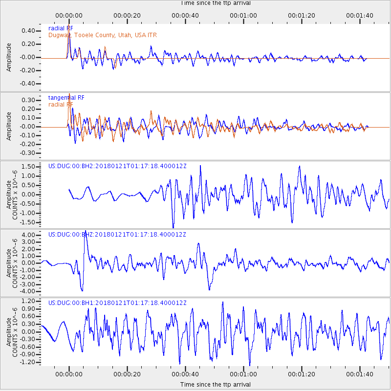
DUG Dugway, Tooele County, Utah, USA - Earthquake Result Viewer
*The percent match for this event was below the threshold and hence no stack was calculated.
| Earthquake location: |
Northern Chile |
| Earthquake latitude/longitude: |
-18.9/-69.6 |
| Earthquake time(UTC): |
2018/01/21 (021) 01:06:42 GMT |
| Earthquake Depth: |
111 km |
| Earthquake Magnitude: |
6.3 Mww |
| Earthquake Catalog/Contributor: |
NEIC PDE/us |
|
| Network: |
US United States National Seismic Network |
| Station: |
DUG Dugway, Tooele County, Utah, USA |
| Lat/Lon: |
40.19 N/112.81 W |
| Elevation: |
1477 m |
|
| Distance: |
71.2 deg |
| Az: |
326.373 deg |
| Baz: |
136.802 deg |
| Ray Param: |
$rayparam |
*The percent match for this event was below the threshold and hence was not used in the summary stack. |
|
| Radial Match: |
75.365326 % |
| Radial Bump: |
400 |
| Transverse Match: |
81.051544 % |
| Transverse Bump: |
400 |
| SOD ConfigId: |
2546091 |
| Insert Time: |
2018-02-04 01:12:46.435 +0000 |
| GWidth: |
2.5 |
| Max Bumps: |
400 |
| Tol: |
0.001 |
|
Signal To Noise
| Channel | StoN | STA | LTA |
| US:DUG:00:BHZ:20180121T01:17:18.400012Z | 5.2769403 | 1.6419165E-6 | 3.1114934E-7 |
| US:DUG:00:BH1:20180121T01:17:18.400012Z | 1.557281 | 4.28993E-7 | 2.7547566E-7 |
| US:DUG:00:BH2:20180121T01:17:18.400012Z | 2.1884348 | 3.7801044E-7 | 1.7273095E-7 |
| Arrivals |
| Ps | |
| PpPs | |
| PsPs/PpSs | |


