You are here: Home > Network List > G - GEOSCOPE Stations List
> Station TAOE Taiohae, Marquises islands > Earthquake Result Viewer
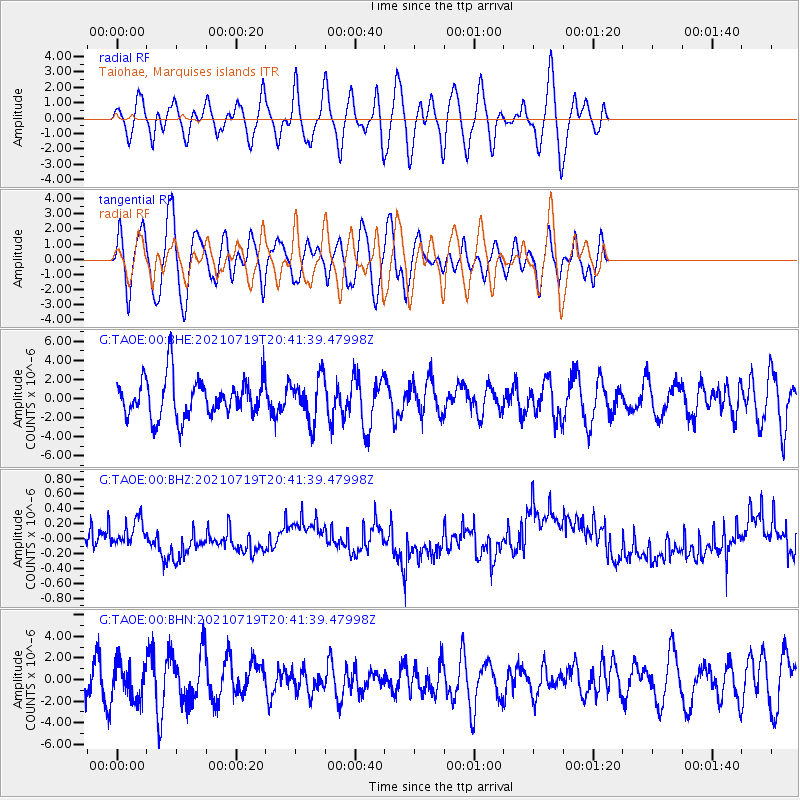
TAOE Taiohae, Marquises islands - Earthquake Result Viewer
*The percent match for this event was below the threshold and hence no stack was calculated.
| Earthquake location: |
Bismarck Sea |
| Earthquake latitude/longitude: |
-3.3/146.6 |
| Earthquake time(UTC): |
2021/07/19 (200) 20:30:41 GMT |
| Earthquake Depth: |
10 km |
| Earthquake Magnitude: |
5.8 mww |
| Earthquake Catalog/Contributor: |
NEIC PDE/us |
|
| Network: |
G GEOSCOPE |
| Station: |
TAOE Taiohae, Marquises islands |
| Lat/Lon: |
8.85 S/140.15 W |
| Elevation: |
800 m |
|
| Distance: |
73.0 deg |
| Az: |
98.195 deg |
| Baz: |
269.227 deg |
| Ray Param: |
$rayparam |
*The percent match for this event was below the threshold and hence was not used in the summary stack. |
|
| Radial Match: |
56.369453 % |
| Radial Bump: |
400 |
| Transverse Match: |
59.21855 % |
| Transverse Bump: |
400 |
| SOD ConfigId: |
25131211 |
| Insert Time: |
2021-08-02 20:37:15.674 +0000 |
| GWidth: |
2.5 |
| Max Bumps: |
400 |
| Tol: |
0.001 |
|
Signal To Noise
| Channel | StoN | STA | LTA |
| G:TAOE:00:BHZ:20210719T20:41:39.47998Z | 1.4079738 | 1.9922676E-7 | 1.4149892E-7 |
| G:TAOE:00:BHN:20210719T20:41:39.47998Z | 0.9792651 | 1.6778421E-6 | 1.7133685E-6 |
| G:TAOE:00:BHE:20210719T20:41:39.47998Z | 1.1244079 | 2.297879E-6 | 2.0436348E-6 |
| Arrivals |
| Ps | |
| PpPs | |
| PsPs/PpSs | |


