You are here: Home > Network List > UW - Pacific Northwest Regional Seismic Network Stations List
> Station UMAT Pilot Rock, OR, USA > Earthquake Result Viewer
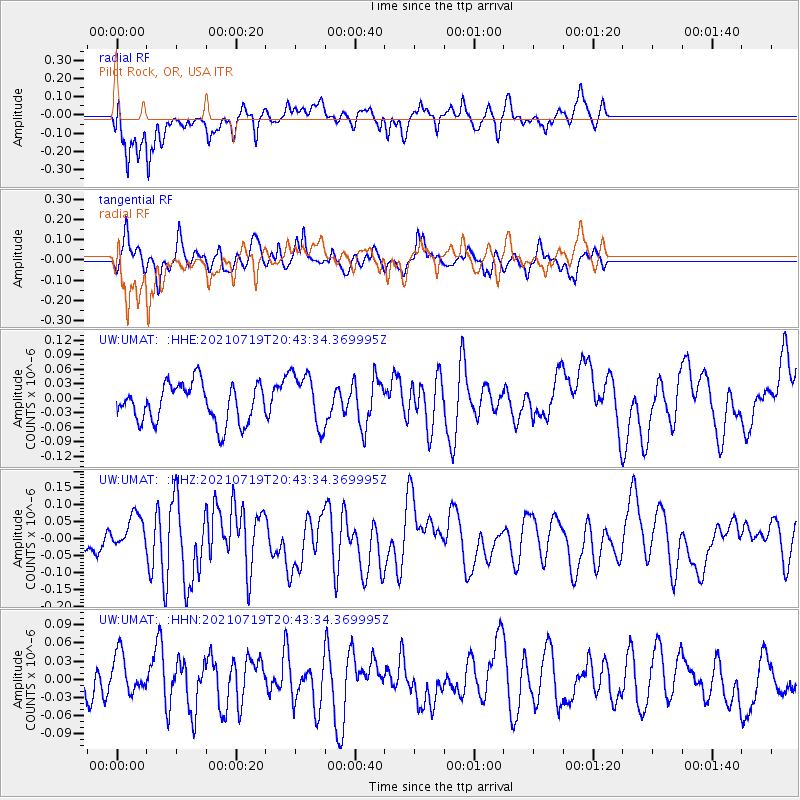
UMAT Pilot Rock, OR, USA - Earthquake Result Viewer
*The percent match for this event was below the threshold and hence no stack was calculated.
| Earthquake location: |
Bismarck Sea |
| Earthquake latitude/longitude: |
-3.3/146.6 |
| Earthquake time(UTC): |
2021/07/19 (200) 20:30:41 GMT |
| Earthquake Depth: |
10 km |
| Earthquake Magnitude: |
5.8 mww |
| Earthquake Catalog/Contributor: |
NEIC PDE/us |
|
| Network: |
UW Pacific Northwest Regional Seismic Network |
| Station: |
UMAT Pilot Rock, OR, USA |
| Lat/Lon: |
45.29 N/118.96 W |
| Elevation: |
1318 m |
|
| Distance: |
95.5 deg |
| Az: |
44.991 deg |
| Baz: |
270.812 deg |
| Ray Param: |
$rayparam |
*The percent match for this event was below the threshold and hence was not used in the summary stack. |
|
| Radial Match: |
70.810074 % |
| Radial Bump: |
400 |
| Transverse Match: |
52.765156 % |
| Transverse Bump: |
400 |
| SOD ConfigId: |
25131211 |
| Insert Time: |
2021-08-02 20:41:41.171 +0000 |
| GWidth: |
2.5 |
| Max Bumps: |
400 |
| Tol: |
0.001 |
|
Signal To Noise
| Channel | StoN | STA | LTA |
| UW:UMAT: :HHZ:20210719T20:43:34.369995Z | 1.0236369 | 5.1020386E-8 | 4.9842267E-8 |
| UW:UMAT: :HHN:20210719T20:43:34.369995Z | 1.0265989 | 3.7807176E-8 | 3.68276E-8 |
| UW:UMAT: :HHE:20210719T20:43:34.369995Z | 1.4249662 | 5.6335725E-8 | 3.9534783E-8 |
| Arrivals |
| Ps | |
| PpPs | |
| PsPs/PpSs | |


